


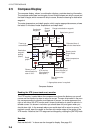
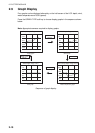
2. PLOTTER DISPLAYS
2-6
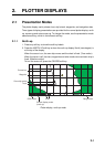
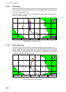
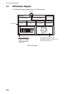
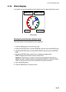
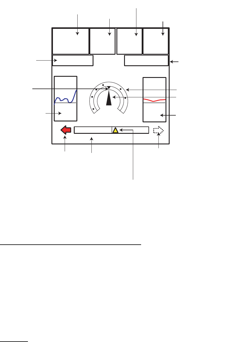
2.5 Compass Display
The compass display, shown in combination displays, provides steering information.
The compass rose shows two triangles: the red triangle shows own ship's course and
the black triangle, which moves with ship's course, shows the bearing to destination
waypoint.
The water temperature and depth graphs, which require appropriate sensors, shows
the latest 10 minutes of water temperature and depth data.
Compass distance
Reading the XTE (cross-track error) monitor
The XTE monitor, located below the compass rose, shows the distance you are off
course and the direction to steer to return to course. The own ship marker in the mon-
itor moves according to direction and distance off course. An arrow appears at the
right or left side of the XTE monitor and it shows the direction to steer to return to in-
tended course. It is shown in red when you should steer left, and green when you
should steer right. In the example above you would steer left to return to course. To
maintain course, steer the vessel so the own ship marker stays at the center of the
XTE monitor. Note that the XTE range can be changed by rotating the [ENTER] knob.
Nav data
Data marked with * in above can be changed to display. See page 2-5.
DEST:
0001WP
DST*
305.3
nm
SOG*
12.0
Kts
TTG:25:26
ETA:12:28AM
DPT
45.6ft
TMP
40.4ºF
155º
STW*
12.4
KTS
N
w
E
Ship's course
(red)
Water temperature
graph**
Shown (in green)
when direction to
steer is "right."
XTE monitor
(See below for
description.)
Shown (in red)
when direstion to
steer is "left".
Depth
graph**
Destination
waypoint
bearing
(black)
Time-to-go
to destination
Own ship marker
(Yellow)
Destination
waypoint
Speed
through
water
Range to destination waypoint
Speed over ground
Bearing scale
Estimated time of
arrival at destination
0.5 0.5
**: Appropriate sensor is required.