


16 GPSMAP 76Cx Owner’s Manual
BaSIc operatIon
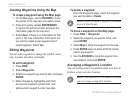
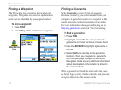
To nd an address:
1. Press FIND.
2. Select �ddresses.
NOTE: If your unit has a GPS x, the <Enter
Region> eld is populated with your current
region. You do not have to specify a city in the
<Enter City>, as the database has information
for the entire region. \
3. Select <Enter Number> and type the street
number using the screen keypad. Select OK.
4. Select <Enter Street Name>. The street list
opens.
5. Use the screen keypad to enter enough of the
street name to show a match. Select OK. A list
of matches appears.
6. Select the address you want.
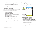
Finding an Intersection
This feature also requires detailed mapping data.
Follow the basic steps for nding an address when
searching for an intersection.
Finding a Marine Point
If using MapSource BlueChart g2 marine cartograpy,
use the Marine menu which contains subcategories
including Wrecks, Tides, Navaids, Marine Services,
Anchorages, and Restricted Areas.
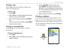
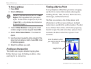
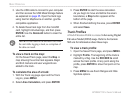
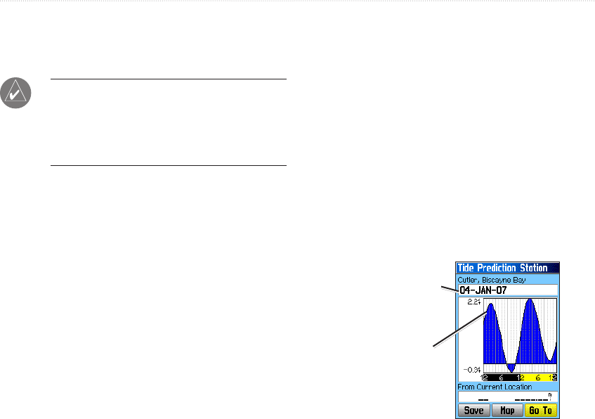
The Tide icon contains a list of tide stations with
information in a 24-hour span starting at midnight
station time is available for each tide station.
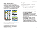
The chart
shows a 24-hour block of time, with the time progressing
from left to right. The solid vertical lines represent 4 hour
increments; the dotted vertical lines represent 1 hour
increments.
Enter the date for which
you want to view the tide
information
Tide Prediction Station
Height of tide