


26 GPSMAP 76Cx Owner’s Manual
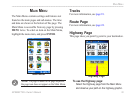
MaIn paGeS
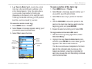
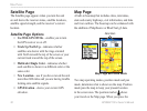
Satellite Page
The Satellite page appears when you turn the unit
on and shows the receiver status, satellite locations,
satellite signal strength, and the receiver’s current
location.
Satellite Page Options
Use With GPS Off/On —enables you to turn
the GPS receiver on or off.
Track Up/North Up—indicates whether
satellites are shown with the rings oriented
with North toward the top of the screen or your
current track toward the top of the screen.
Multicolor/Single Color—indicates whether
each satellite is shown in a different color or the
same color.
New Location—use if you have moved the unit
more than 600 miles and you are having trouble
locking onto satellite signals.
GPS Elevation—shows your current GPS
elevation.
•
•
•
•
•
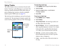
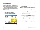
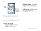
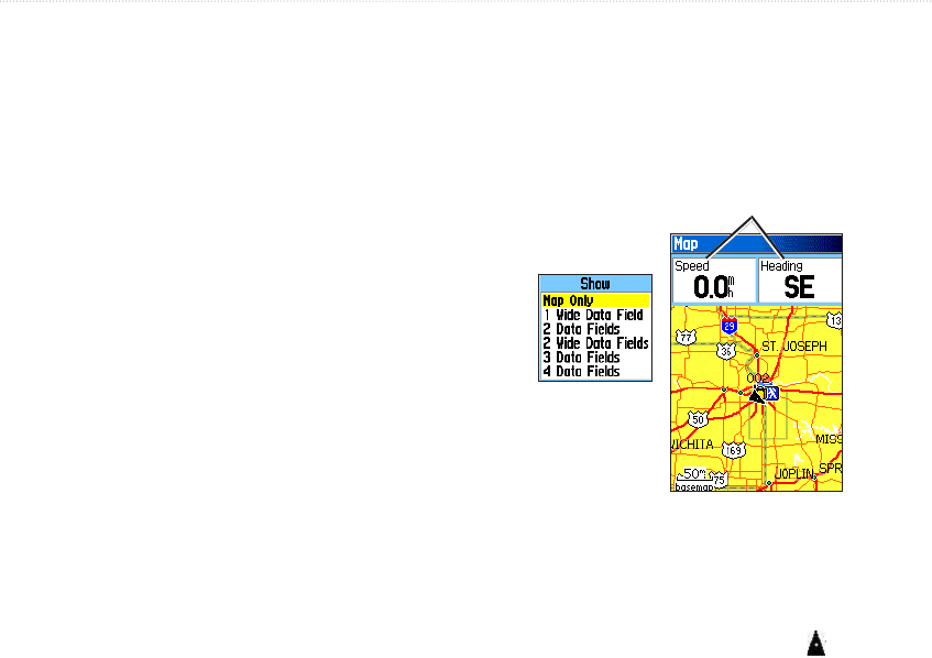
Map Page
A built-in basemap that includes cities, interstates,
state and county highways, exit information, and lake
and river outlines. The basemap can be enhanced with
the addition of MapSource or BlueChart g2 data.
Data elds
Show sub-menu
Map Page with data elds
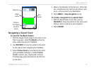
Two map operating modes, position mode and pan
mode, determine what is shown on the map. Position
mode pans the map to keep your present location
in the screen area. The position marker shows
your travel on the Map page. When you press the