


17
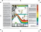
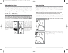
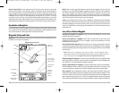
Routes link two or more waypoints together to create a path for navigation, and are used in trip
planning. You can link individual waypoints together by using the GOTO key. A route represents
your intended navigation and shows the shortest path from each waypoint to the next. As you
travel a route, staying on the route line is the most efficient way to get to your destination,
although you should always look out for obstacles not shown on the chart. Your FishFinder can
store up to 10 routes that can each contain up to 20 waypoints.
Tracks consist of detailed position history, and are displayed as a breadcrumb trail of trackpoints.
The Current Track shows the position history since the unit was powered up (maximum of 2000
trackpoints displayed). You can clear the Current Track or save it at any time. Your FishFinder can
store up to 10 saved tracks, each containing 2000 trackpoints. The current track represents your
actual path so far.
Save, Edit, or Delete a Waypoint
Save your current position as a waypoint: On any view, press the MARK key to save the current
position of the boat as a waypoint.
Save the cursor position as a waypoint: On the Chart or Combo view, use the Cursor key to
designate the position you want to save as a waypoint. Then press the MARK key to save the
marked position as a waypoint.
Save a position from the sonar history: On the Sonar view, use the Cursor key to point to a feature
in the sonar history (also called the Sonar Saver feature). Press the MARK key to create a waypoint
at the location where that sonar reading was taken. The new waypoint will also record the depth
at that location.
NOTE: When you save a waypoint by any of these methods, a numerical waypoint name is
automatically assigned. You can edit the waypoint information later to give it a different name and
select an icon to represent it (see Waypoint submenu on the Navigation Main Menu Tab).
Display the Waypoints Submenu: From any view, press the MENU key twice to display the Main
Menu System, then use the RIGHT Cursor key to select the Navigation tab. Select Waypoints and
press the RIGHT Cursor key to display the Waypoints submenu.
Program a specific position as a waypoint: To create a waypoint that is NOT your current position,
from the Waypoints submenu, select the Create option and press the RIGHT Cursor key. Use the
Cursor keys to program a waypoint name, latitude, longitude, and icon before selecting Save.
Edit a waypoint: From the Waypoints submenu, select Edit and press the RIGHT Cursor key to
display a list of saved waypoints. Select the waypoint you want to edit and press the RIGHT Cursor
key. Use the 4-WAY Cursor Control key to move from field to field, and the UP and DOWN Cursor
keys to changes values once you are in a field. In the Waypoint Name, Latitude and Longitude
fields, use the UP and DOWN Cursor keys to change the letter or number. All upper and lower case
16
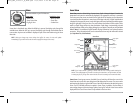
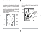
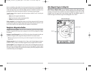
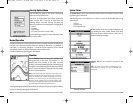
Nearest Current Station: Current information for the nearest current station to your present
position will be displayed. This includes the position of the station and the current changes for
today. Two graphs are also presented that show the time, direction and flow speed of the current
changes for the 24 hour time period of today’s date. You can change the date to look at current
information before or after the date displayed by pressing the LEFT or RIGHT Cursor key
respectively. Press the EXIT key to remove the information box and the Bullseye Cursor will be
centered over the current station position. The Cursor Information Boxes at the bottom of the
display will indicate the distance and bearing to the current station from your present position.
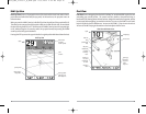
Introduction to Navigation
Use the FishFinder to establish waypoints at areas of interest and to navigate to those waypoints
via a saveable route (representing the shortest intended distance between waypoints). You can
also view and save tracks, which represent the actual path of the boat.
Waypoints, Routes and Tracks
Waypoints are stored positions that allow you to mark areas of interest or navigation points. Your
FishFinder can store up to 750 waypoints.
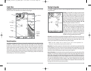
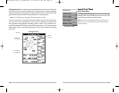
Waypoints, Routes and Tracks
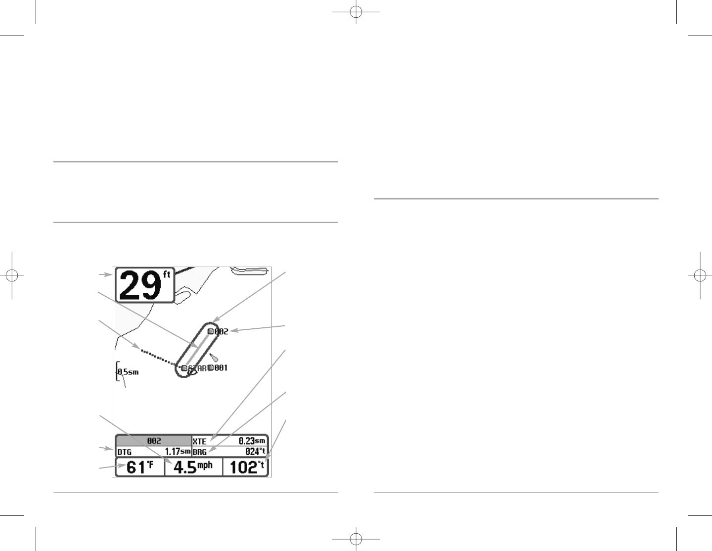
Depth
DTG: Distance
to Go to
Waypoint
Water Surface
Temperature
Bearing of
Boat with
Respect to
North
Reference
BRG: Bearing to
Waypoint
XTE: Cross Track
Error. Distance of
Boat from Route
Waypoint
Track
Route
Off Course
Alarm Limits
Speed of Boat
FF595_Man_531385-1_A_PrfE.qxd 12/9/2004 2:40 PM Page 22