


16
View Orientation
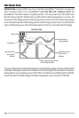
Both Chart and Combo views allow you to choose the orientation of the view. When North-Up
orientation is selected, True North is shown at the top of the display. In other words, objects located to
the north of the boat are drawn above the boat. When Course-Up orientation is selected, the direction
of motion of the boat is shown at the top of the display. In other words, objects ahead of the boat are
drawn above the boat. In both orientations, the view pans automatically, so that the boat is always
centered on the display. When the boat is stationary, it is drawn as a circle. When the boat is in motion,
it takes on a boat shape, pointed in the direction of motion (always Up in the Course-Up orientation).
Viewing Cartography
In the Chart or Combo Views, there are several cartography-related functions that you can access
using various keys.
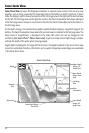
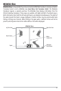
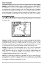
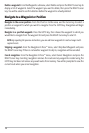
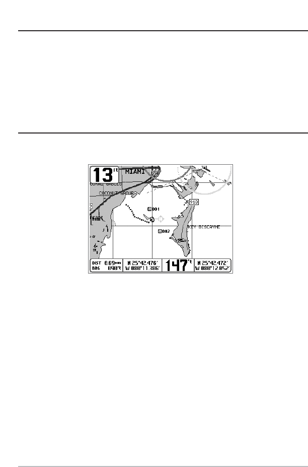
Panning: Use the 4-WAY Cursor keys to move the chart around on the display in the direction of the
key being pressed. When you do this, a bullseye cursor is drawn at the center of the screen and is
linked to the boat by a yellow line, even if the boat is off the screen. At the same time, the
temperature and speed boxes in the lower left corner are replaced with the distance and bearing
from the boat to the cursor position and the latitude/longitude coordinates of the cursor.
Zooming: Use the Plus (+) key to Zoom In and the Minus (-) key to Zoom Out showing the
cartography at different scales. The scale is indicated on the left side of the display. If you zoom in
beyond the available chart data, the display will go into Overzoom mode whereby the last
available chart data is amplified to reflect the scale selected. If you zoom in so far that no
cartography is available, a lat/long grid will be drawn instead.
Chart Info: Use the INFO key to get detailed information about the chart. If the cursor is active, you
will see information about the chart objects located near the cursor. If the cursor is not active, the
Chart Info menu will appear. You can select the nearest port, the nearest tide station, or the nearest
current station to see information about any of these objects.
Chart View with Cursor Present