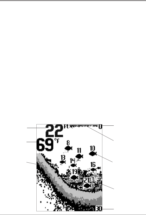
Sonar View
Sonar View presents a historical log of sonar returns. The most recent sonar
returns are charted on the right side of the display. As new information is
received, the historical information scrolls left across the display.
• Upper and Lower Depth Range numbers indicate the distance from
the surface of the water to a depth range sufficient to show the bottom.
• Sensitivity: Press the UP or DOWN Arrow keys to adjust the Sensitivity.
(See Sonar Menu: Sensitivity)
• Zoom: See Sonar Menu: Zoom to adjust the magnification of the view.
The Zoom Level, or magnification, will be displayed on the screen.
• Sonar Menu: To access related Sonar and Setup menu options, see
Sonar Menu.
• Mark Waypoints (PiranhaMAX 176i and 196ci only): Press the
CHECK/ENTER key to mark the current position of the boat as a
waypoint. Waypoints are saved in numerical order.
NOTE: Waypoints are saved to the unit even after it is powered off. Tracks are not
saved after the unit is powered off.
Lower Range
Upper Range
Depth
Bottom Contour
Surface Clutter
Shaded Fish Symbol
Structure
Sonar View (PiranhaMAX 165)
Temperature
51
Sonar View


