


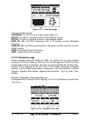

Page 60 GPS Chart 150C
Nav-Aids:US / US Simple / INT / INT Simple / Off. The default setting is US. When
selected it affects Lights, Signals, Buoys & Beacons display.
- INT(ernational): Draws Nav-Aids using international symbology. All compo-
nents of Complex Objects are shown.
- INT(ernational) Simplified: Shows Complex Object with one icon only. Non-
complex Nav-Aids are shown using international symbology.
- US: Draw Nav-Aids using NOAA symbology. All components of Complex
Objects are shown.
- US Simplified: Shows Complex Object with one icon only. Non-complex Nav-
Aids are shown using NOAA symbology.
- Off: Lights, Signals, Buoys & Beacons are no longer displayed on the charts.
Light Sectors: Enables / Disables the display of Light Sectors. The default setting
is On.
Attention Areas: Enables / Disables the display of Attention Areas (areas in which
special attention by the mariner is required, due to some natural or man-made
hazards or sailing regulations and restrictions). The default setting is On. The
Attention Areas will always be contour only when On.
Tides & Current:Enables / Disables the display of Tides and Currents. The
default setting is On. When tide and currents display is disabled, the Tide
Stations search cannot be activated (see Section 3.15.5.3).
Seabed Type: Enables / Disables the display of Seabed Type. The default setting
is On.
Ports & Services: Enables / Disables the display of Ports and Services (areas
along shore with facilities for mooring, downloading and uploading ships,
generally sheltered from waves and winds). The default setting is On. When
Ports and Services display is disabled, the Port By Name and Port Services
search cannot be activated (see Section 3.15.5.2 and 3.15.6).
Tracks & Routes: Enables / Disables the display of Tracks and Routes (recom-
mended and established routes for ships at sea, including traffic separation
schemes, deep waters routes…). The default setting is On.
Underwater Objects: Enables / Disables the display of underwater objects
(objects like e.g. obstruction, wreck, cable…). The default setting is On.
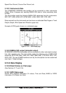
Depth Settings
The Depth Settings menu controls the depth information shown on the Chart page.
Depth Areas: Enables / Disables the display of Depth Areas. The default setting
is On.
Depth Areas >: Sets a min reference depth value. The default setting is 5 Ft.
Depth Areas <: Sets a max reference depth value. The default setting is 00005 Ft.
Depth Lines & Soundings: Enables / Disables the display of Depth Lines and
Soundings. The default setting is On.
Depth Lines & Soundings >: Sets a min reference depth & soundings value. The
default setting is 00000 Ft.
Depth Lines & Soundings <: Sets a max reference depth & soundings value. The
default setting is 01000 Ft.