


141
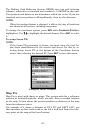
Map Auto Zoom
This receiver has an auto zoom feature that eliminates a lot of the but-
ton pushing common with other brands of GPS receivers. It works in
conjunction with the navigation features.
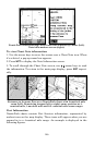
Start navigating to a waypoint. Then, with the auto zoom mode on, the
unit zooms out until the entire course shows, from the present position
to the destination waypoint. As you travel toward the destination, the
unit automatically zooms in — one zoom range at a time — keeping
your current position and the destination on the screen.
To turn this feature on from the
MAP PAGE, press MENU|↓ to AUTO
ZOOM|ENT|EXIT. Repeat these steps to turn it off.
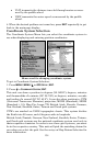
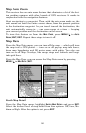
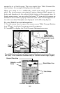
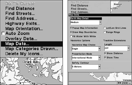
Map Data
From the Map Data menu, you can turn off the map — which will turn
the map into a GPS plotter — turn on or off pop-up map info boxes,
draw map boundaries and fill water areas with white. You also can
turn on or off Map Overlays, like range rings and latitude and longi-
tude grid lines.
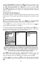
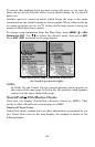
From the Map Page, you can access the Map Data menu by pressing
MENU|↓ to MAP DATA|ENT.
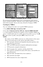
Map menu (left). Map Data menu (right).
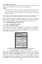
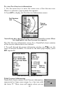
Earth Map Detail
From the Map Data menu, highlight
EARTH MAP DETAIL and press ENT.
Select the desired level of map detail from four options: Off, Low, Me-
dium or High. After the option is set, press
EXIT.