


145
To correct this problem track-up mode rotates the map as you turn. So
what you see on the left side of the screen should always be to your left
and so on.
Another option is course-up mode, which keeps the map at the same
orientation as the initial bearing to the waypoint. When either track-up
or course-up modes are on, an "N" shows on the map screen to keep you
aware of which direction is north.
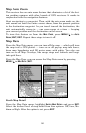
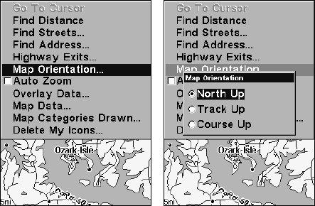
To change map orientation from the Map Page, press
MENU|↓ to MAP
ORIENTATION|ENT. Use ↑ ↓ to select the desired mode, then press ENT.
Press
EXIT|EXIT to return to the page display.
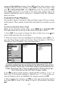
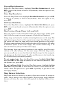
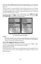
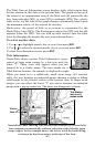
Map Menu (left). Map Orientation menu with
the North Up selected (right).
NOTE:
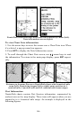
In North Up and Course Up, the present position arrow appears in
the center of the map page. In Track Up, the position arrow appears
centered in the lower third of the page.
NauticPath USA Marine Charts
Your unit can display NauticPath electronic charts on MMCs. They
work just like a MapCreate custom map on a MMC.
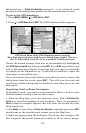
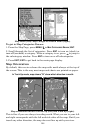
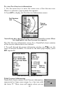
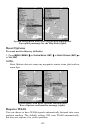
Nautical Chart Notes
NauticPath charts contain notes or chart information, represented by cir-
cle-i Chart Note icons on the map display. An example is shown in the
following figure.