


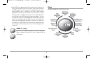
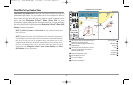
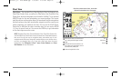
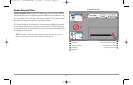
Chart View
Chart Views - The standard Chart, Chart Big Digits, Chart No Readouts, and
Chart/Chart Combo Views, as well as the Chart side of the Chart/Bird's Eye
Combo View, all show cartography from the built-in UniMap™ or an optional
MMC/SD map for the area surrounding your current position. The current
track (also known as the position history or breadcrumb trail) showing where
the boat has been, along with saved tracks, waypoints, and the current route
(when navigating), are overlaid on the chart. You can use the 4-WAY Cursor
Control key to shift/pan the chart to another area. You can use the ZOOM
(+/-) keys to zoom in and out. You can use the INFO key to get information
on the chart objects near the cursor.
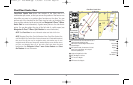
NOTE: Standard Chart View, Chart No Readouts View, Chart/Chart Combo View,
and Chart/Bird's Eye Combo View all share the same set of 5 selectable readouts,
that can all be set one way for navigation mode, and another way for non-
navigation mode. When you change the readouts display on one of these views,
you also are changing them on all the other views that share the same
configuration. See Navigation X-Press™ menu: Select Readouts and Select
Nav Readouts for more information.
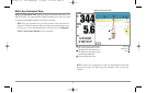
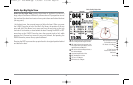
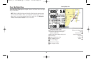
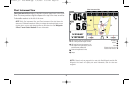
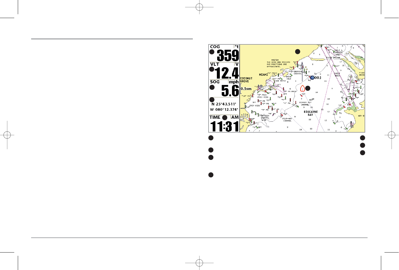
Chart View without Active Cursor, shown with
Optional-Purchase Navionics® Cartography
COG: Course Over Ground; the current direction the
boat is traveling measured in degrees from North.
Time
1
5
Voltage
Land Contours
2
6
SOG: Speed Over Ground; the measurement of the
boat’s progress across a given distance, and is the
speed measurement provided by GPS.
Boat Icon
3
7
Latitude and Longitude Position of Boat
4
1
2
4
5
6
3
7
26
531569-1_B - 955c ManE.qxp 3/4/2007 5:03 PM Page 26