


63Northstar Explorer 657 Installation and Operation Manual
NMEA datum offset
If you select a map datum other than WGS 84,
the map datum offset can be applied to latitude
and longitude coordinates sent on the 657 NMEA
output:
Latitude and longitude coordinates
displayed on any NMEA repeater do not
match the coordinates on the 657. Latitude
and longitude coordinates broadcast on any
NMEA VHF transmitter will be the same as the
coordinates on a WGS 84 chart.
Latitude and longitude coordinates
displayed on any NMEA repeaters match the
coordinates on the 657. However, latitude
and longitude coordinates broadcast on any
NMEA VHF transmitter will be slightly offset
from coordinates on a WGS 84 chart.
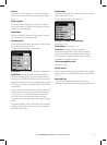
Map shift
!
WARNING
Map shift is for eliminating minor offsets.
It should not be used if the correct datum
is available. Use map shift with caution:
incorrect application will cause incorrect boat
positions.
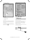
Some charts have consistent position errors. To
correct this, apply a map shift. After a map shift:
The positions of cartographic features (such
as land, rocks, buoys and depth contours)
move on the 657 chart window to where they
should be.
The positions of the boat, waypoints, tracks,
and lines of latitude and longitude on the 657
chart window remain unchanged.
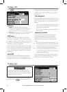
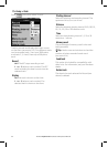
Applying a map shift
1 Move the boat to a known point on the chart,
for example a marina berth.
2 In the Chart setup menu, select
Map shift.
3 Move the cursor to the position on the chart
where the boat actually is.
4 Press
and select Set.
5 Press
to set the new map shift.
The boat will now be displayed at its
actual location.
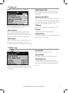
Clearing the map shift
Clearing the map shift removes any map shift
from the cartographic features on the 657 chart
window.
1 In the Chart setup menu, select
Map shift.
2 Press
and select Clear.
3 Press
.
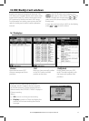
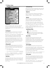
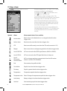
General submenu
Plotter mode
Normal: only scales available on the chart card can be displayed
If you press or to select a chart scale which is not available, on the chart card, the
chart window will change to this scale but will only display the boat position and track (if enabled).
The rest of the display is white with black crosshatch lines and no chart information is displayed. This
is useful to zoom to a small scale to track small boat movements or if there is no detailed chart for
an area
Mixing levels
Mixes lower detail charts with higher detail charts on chart boundaries
Lower detail chart is not shown
Lower detail chart shown; this is slower to redraw
Anticlutter
Names and icons shown. Note: this is independent of the change in detail shown at diff erent
zoom levels
Hides some less important names and icons to make the chart clearer
Value added data
Non marine chart data shown