


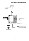
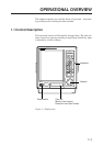
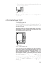
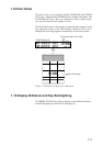


1-7
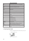
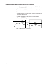
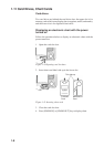
1.9 Chart Scale
The chart scale can be adjusted with the [ZOOM IN] and [ZOOM
OUT] keys. Note that the [ZOOM IN] key shrinks the picture, and
the [ZOOM OUT] key “blows up” the picture. With a smaller range,
you may find that the track appears in tiers.
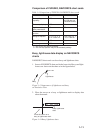
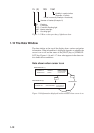
The horizontal range of the display in nautical miles appears at the
top right-hand corner of the Data Display. Whenever the scale is
changed the new range appears momentarily at the screen center.
34° 44.258’ N 340.5° 123.4NM
134° 40.719’ E 341.2°
0’ 10"
GPS 1.2
Horizontal range
Horizontal range (123.4 NM)
DATA DISPLAY (2)
123.4NM
Figure 1-9 Location of chart scale indications
1.10 Display Brilliance and Key Backlighting
The [BRILL ECONO] key adjusts display screen brilliance and key-
board backlighting in seven levels including off.