


Getting Satellite Signals
After you turn on the GPSMAP 378/478, the unit automatically
begins searching for satellites. The GPS Page appears while the unit
is gathering satellite signals and acquiring a x, which should take
only a few minutes. While the GPSMAP 378/478 is getting satellite
signals, the GPS Page shows the status as “Acquiring Satellites.”
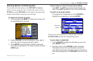
GPS Tab
NOTE: While acquiring satellites, the Map Page might show
the wrong location, such as China. You need to wait a few more
minutes to acquire satellites and nd your current location.
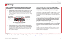
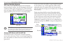
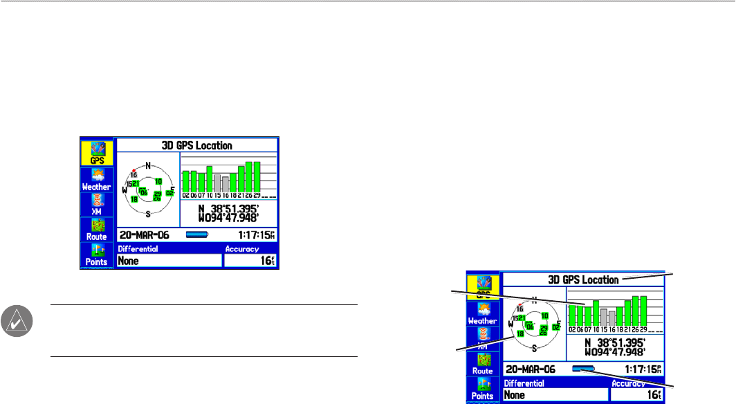
Viewing GPS Status with the GPS Tab
The GPS tab provides a visual reference of satellite acquisition,
receiver status, and accuracy. The sky view and signal strength bars
show what satellites are visible to the receiver and whether they are
being tracked.
As the receiver locks onto satellites, a signal strength bar appears
for each satellite in view, with the appropriate satellite number
underneath each bar. The numbers below each bar represent the
particular satellite that is being received. Numbers above 33 indicate
WAAS satellites.
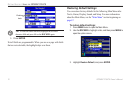
The sky view shows a bird’s eye view of the position of each
satellite relative to the receiver’s last known position. The outer
circle represents the horizon (north up), the inner circle represents
45º above the horizon, and the center point represents a position
directly overhead. You can also set the sky view to a Track Up
conguration, causing the top of the sky view to align along your
current track heading. Press MENU to change the conguration of
the sky view.
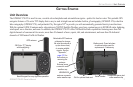
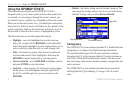
GPS Page
Receiver
status eld
Sky view
Signal
strength bars
Power
source
indicator
4 GPSMAP 378/478 Owner’s Manual
gettIng stArted > gettIng sAtellIte sIgnAls