


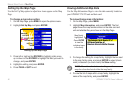

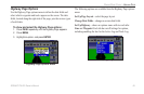
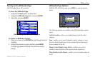
Highway Page
The Highway Page is available in both Marine Mode and
Automotive Mode.
Highway Page
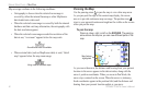
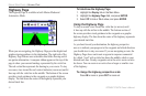
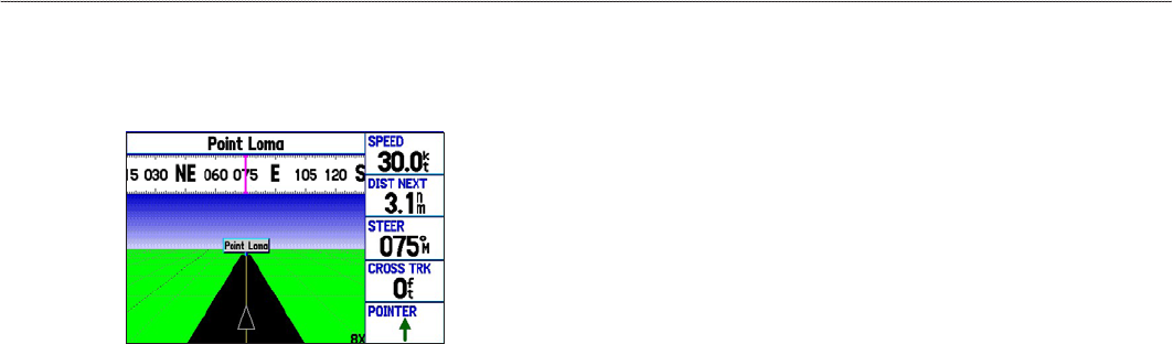
When you are navigating, the Highway Page provides digital and
graphic steering guidance to the destination. The right side of the
Highway Page features user-selectable data elds showing useful
navigation information. A compass ribbon appears at the top of the
page to show your current heading, represented by the violet bar.
The red vertical bar represents the bearing to your course. To stay
on course, steer toward the red vertical indicator (or arrows) until it
lines up with the violet bar in the middle. The bottom of the screen
provides visual guidance to the waypoint on a graphic highway
display. The line down the center of the highway represents your
desired track line.
To hide/show the Highway Page:
1. Highlight the Display tab on the Main Menu.
2. Highlight the Highway Page eld, and press ENTER.
3. Select Off to hide or On to show, and press ENTER.
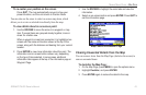
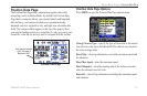
Using the Highway Page
To stay on course, steer toward the violet bar (or arrows) until
it lines up with the red bar in the middle. The bottom section of
the screen provides visual guidance to the waypoint on a graphic
highway display. The line down the center of the highway represents
your desired track line.
As you head toward your destination, the highway perspective
moves to indicate your progress to the waypoint and which direction
you should steer to stay on course. If you are navigating a route, the
Highway Page shows each route waypoint in sequence connected
by a black “road” with a white line down the middle, which is your
desired track line. Nearby waypoints not in the active route can also
be shown. You can zoom in or out to show a larger or smaller view
of the highway.
To change the highway perspective scale:
Press IN to zoom in; press OUT to zoom out.
48 GPSMAP 378/478 Owner’s Manual
MArIne Mode PAges > hIghWAy PAge