


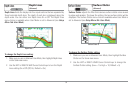
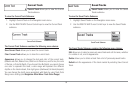

Track Color Range
Track Color Range allows you to set the depth
range that will be displayed as black, the deepest depth, when Color By
Depth is selected as the style for the current track (see Navigation Menu
Tab: Current Track).
NOTE: Only an optional-purchase transducer with a 50 kHz frequency will allow
you to track to 3,000 feet.
To change the Track Color Range:
1. Highlight Track Color Range on the Navigation main menu.
2. Use the LEFT or RIGHT 4-WAY Cursor Control keys to change the
Track Color Range setting. (50 to 3000 feet or 20 to 1000 meters
[International Units only], Default = 50 ft, 20 m)
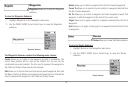
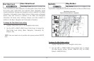
Map Datum
(Advanced)
Map Datum allows you to change the map coordinate system used by the
900 Series™ to match those of a paper map.
To change the Map Datum setting:
1. Make sure you are in Advanced User Mode, then highlight Map
Datum on the Navigation main menu.
2. Use the LEFT or RIGHT 4-WAY Cursor Control keys to change the
Map Datum setting. (Default = WGS 84)
Course Projection Line
Course Projection Line allows you to display
or hide an arrow extending from the bow of the boat that projects your
current course, and shows where the boat will go if you continue on your
present course.
T
o change the Course Project Line setting:
1. Highlight Course Projection Line on the Navigation main menu.
2. Use the LEFT or RIGHT 4-WAY Cursor Control keys to change the
Course Projection Line setting (Hidden, Visible, Default = Visible)
Export All Nav Data
(Advanced)
Export All Nav Data allows you to export all saved Tracks, Waypoints and
Routes to an MMC/SD card.
To Export All Navigation Data:
1. Make sure you are in Advanced User Mode, and that an optional-
purchase MMC/SD card is installed in the slot, then highlight Export
All Nav Data on the Navigation main menu.
2. Use the RIGHT 4-WAY Cursor Control key to export all navigation
data.
92