


10-3
A3280 Rev 1.2
Weather Station Operation/Installation Manual
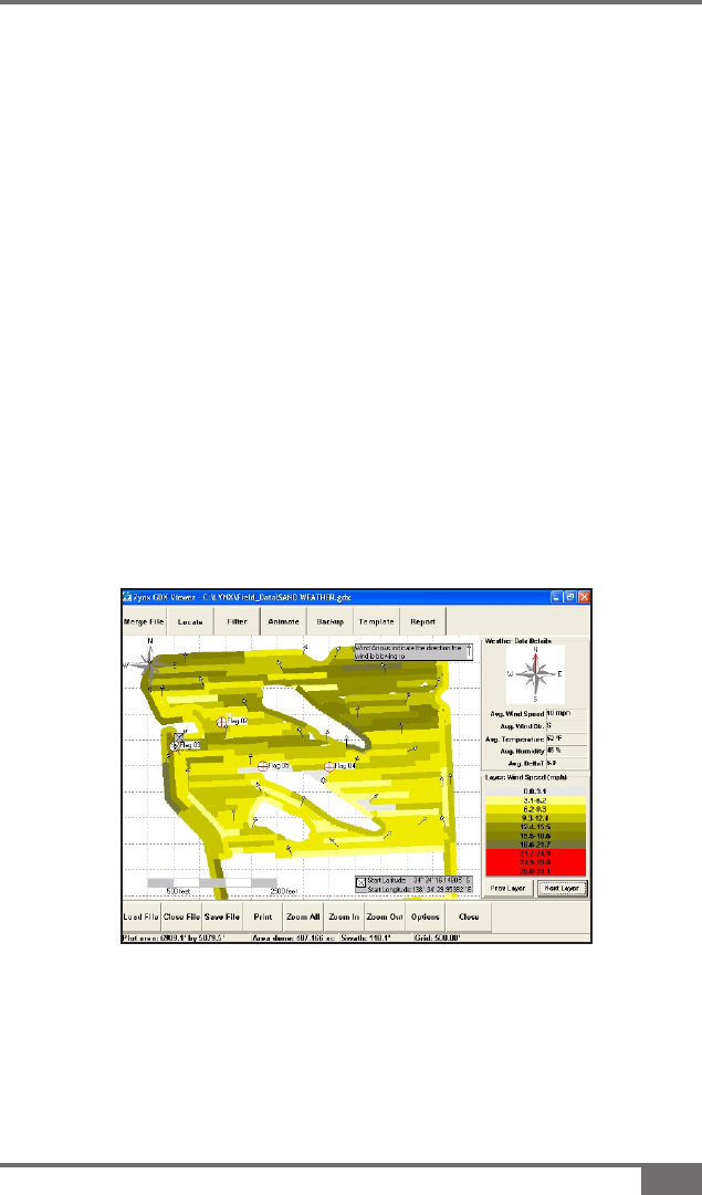
The weather data is recorded every minute with the GPS position, wind
speed, wind direction, temperature, humidity and Delta T. This weather
data is saved with the Guidance Coverage Map, when the eld is saved,
the Weather data log can also be printed using the GDX Viewer
software.
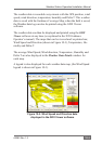
The weather data can then be displayed and printed using the GDX
Viewer software at any time (as explained in the X20 Guidance
Operator’s manual). The maps that can be viewed and /or printed are;
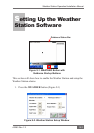
Wind Speed and Direction (shown in Figure 10-3), Temperature, Hu-
midity and Delta-T.
The average Wind Speed, Wind direction, Temperature, Humidity and
Delta T are also displayed in the Weather Data Details window for
each map.
A legend is also displayed for each weather data map, (the Wind Speed
legend is shown in Figure 10-3).
Figure 10-2. Wind Speed and Direction data
displayed in the GDX Viewer software