


7. CUSTOMIZING YOUR UNIT
7-15
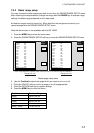
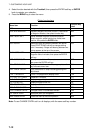
Contents of chart configuration menu (Navionics GOLD) (con’t from previous page)
Item Description Settings
Marine Features Turn marine features on or off. On, Off
Land Features Turn land features on or off. On, Off
CONTOUR LINE Soft key
Spot Soundings Turn water depth display on or off. On, Off
Safe Contour
Shading
Paint areas in dark blue (default
color) which are shallower than
depth value set.
2m (or equivalent ft, fa or PB)
5 m (or equivalent ft, fa or PB)
10 m (or equivalent ft, fa or PB)
20 m or equivalent ft, fa or PB)
Depth Contour Display depth contours. ALL: Display all depth contours
5 m: Display only 5 m* depth
contours
10 m: Display only 10 m* depth
contours.
20 m: Display only 20 m* depth
contours
OFF: Turn off depth contours.
* Or equivalent ft, fa or PB.
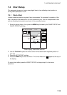
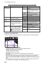
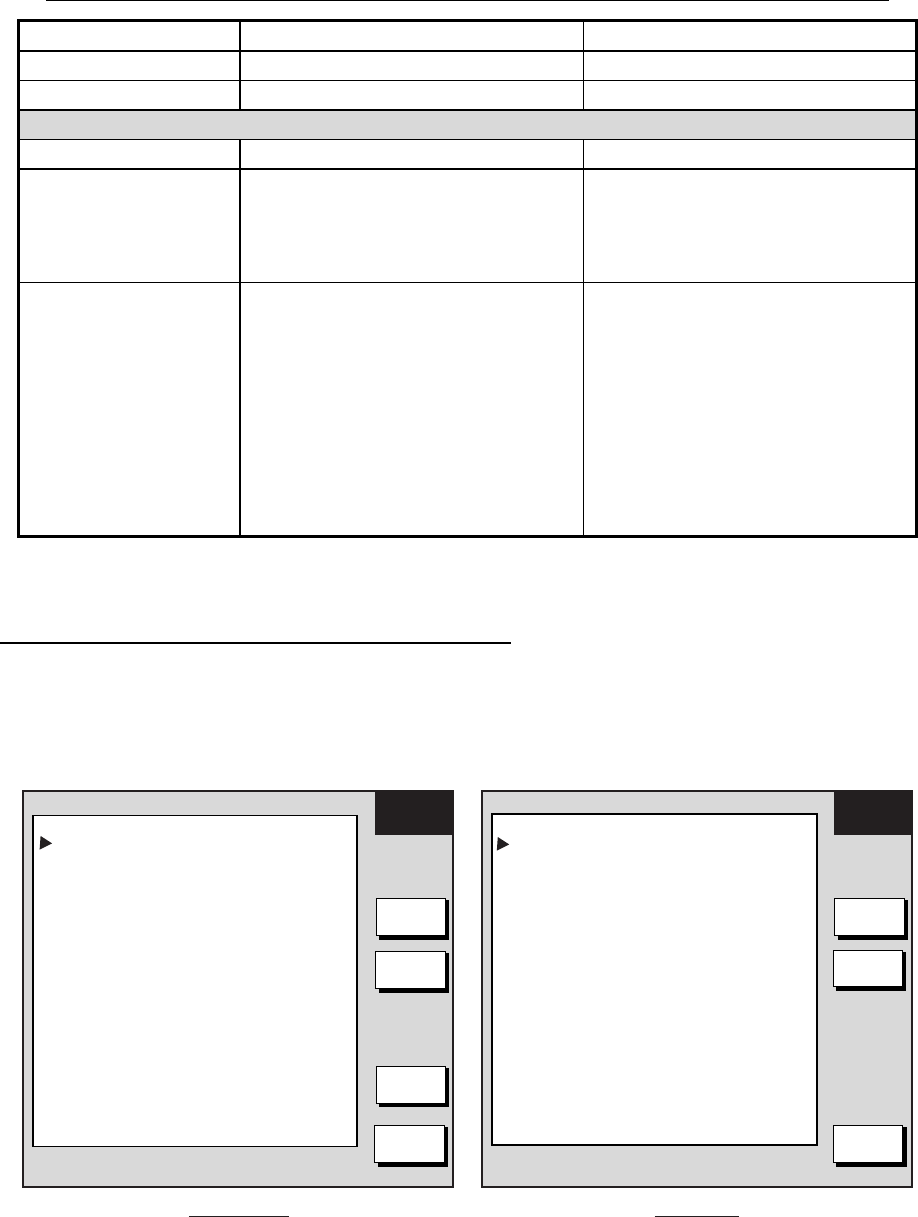
7.4.3 C-MAP chart attributes
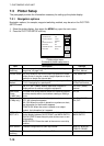
Displaying the CHART CONFIGURATION menu
C-MAP chart attributes may be turned on or off from the CHART CONFIGURATION menu:
1. Press the MENU key.
2. Press the CHART SETUP and CHART CONFIGURATION soft keys.
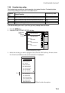
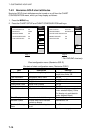
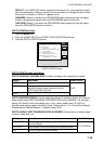
CHART
CONFIG
EDIT
NEXT
PAGE
RETURN
CHART
CONFIG
EDIT
PREV.
PAGE
Page 2Page 1
SEABED TYPE PLOTTER/OVERLAY
PORTS & SERVICES PLOTTER/OVERLAY
TRACKS & ROUTES PLOTTER/OVERLAY
UNDERWATER OBJECTS PLOTTER/OVERLAY
RIVERS & LAKES PLOTTER/OVERLAY
LAND FEATURES PLOTTER/OVERLAY
LANDMARKS PLOTTER/OVERLAY
LAT/LON GRID PLOTTER/OVERLAY
CHART BOUNDARIES
AUTO
PLOTTER/OVERLAY
MIXING OFF
CHART LEVEL UNLOCK
VALUE-ADDED DATA PLOTTER/OVERLAY
CAMERA ICON PLOTTER OVERLAY
PERSPECTIVE ON
DE-CLUTTER ON
CHART DISPLAY MODE FULL
SAFETY STATUS PLOTTER/OVERLAY
WAYPOINT PLOTTER/OVERLAY
WAYPOINT NAME PLOTTER/OVERLAY
NAMES PLOTTER/OVERLAY
BUOYS NAME PLOTTER/OVERLAY
NAV-AIDS US
LIGHT SECTORS FLASHING
PLOTTER/OVERLAY
ATTENTION AREAS PLOTTER/OVERLAY
TIDES & CURRENTS PLOTTER/OVERLAY
DEPTH
CONFIG
DEPTH
CONFIG
Chart configuration menu (C-MAP)