


7. CUSTOMIZING YOUR UNIT
7-24
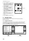
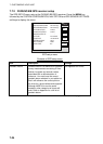
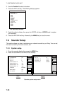
7.7.2 FURUNO BB GPS receiver setup
The GPS SETUP menu sets up the FURUNO BB GPS recceiver. Press the MENU key
followed by the SYSTEM CONFIGURATION, NAV OPTION and GPS SENSOR SETTINGS
soft keys to display this menu.
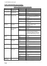
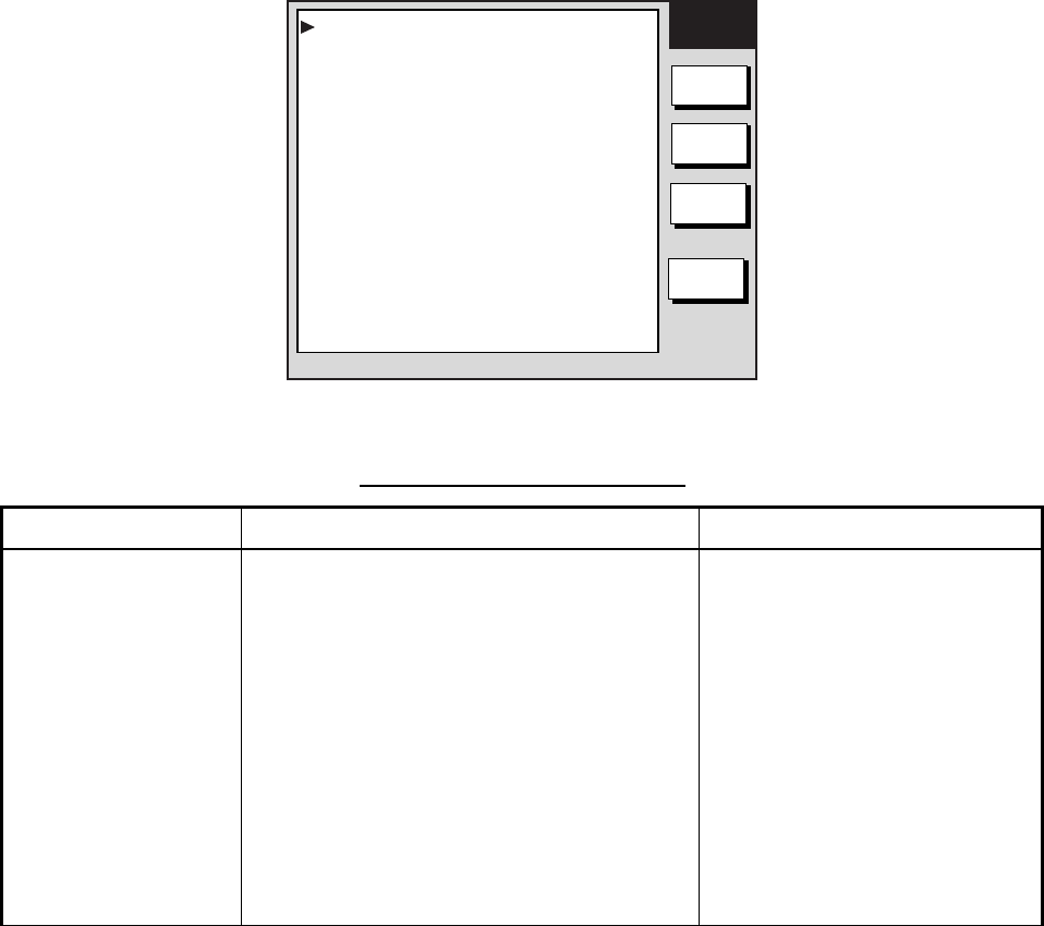
GPS
SETUP
EDIT
GPS
STATUS
RETURN
GEODETIC DATUM WGS-84
POSITION SMOOTHING 000 second (s)
SPD/CSE SMOOTHING
005 second (s)
LATITUDE OFFSET 0.000’N
LONGITUDE OFFSET
0.000’E
DISABLE SATELLITE - - - - - -
LATITUDE 45
°
35.000’N
LONGITUDE 125
°
00.000’W
ANTENNA HEIGHT
005 m
GPS FIX MODE 2D/3D
COLD START NO
WAAS
SET UP
GPS setup menu
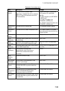
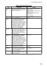
Contents of GPS setup menu
Item Description Settings
Geodetic Datum
Geodetic datum is a reference for geodetic
survey measurements consisting of fixed
latitude, longitude and azimuth values
associated with a defined station of
reference. You must have the correct
geodetic datum selected in your plotter so
that it will reference the correct point on
the chart for a given latitude and longitude.
Although WGS-84 is now the world
standard, other categories of charts still
exist. Refer to Appendix for a full list of
geodetic datum.
See Appendix for full list.
(Con’t on next page)