


3. PLOTTER OPERATION
3-3
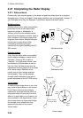
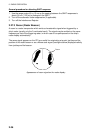
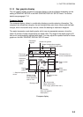
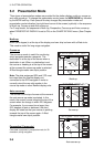
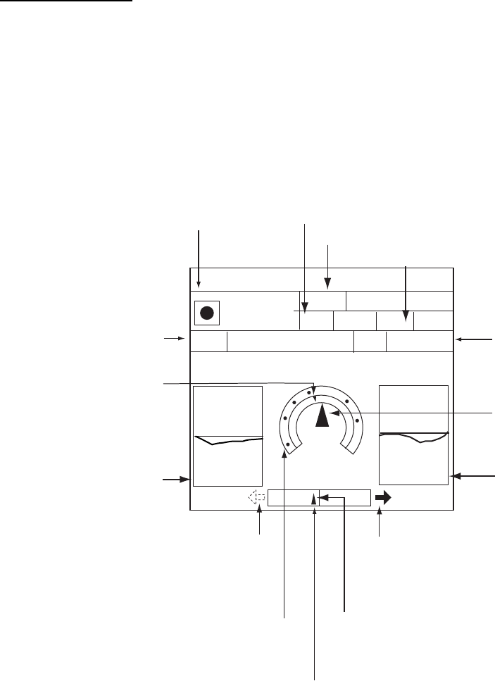
3.1.2 Nav graphic display
The nav graphic display shows the compass display or the wind display depending on the
setting of GRAPHIC METER in the NAV GRAPHIC DISPLAY SETUP menu. For further
details see paragraph 7.10.
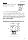
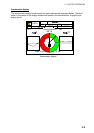
Compass display
The compass display, shown in combination displays, provides steering information. The
compass rose shows two triangles: the red triangle shows own ship’s course and the black
triangle, which moves with ship’s course, shows the bearing to destination waypoint.
The water temperature and depth graphs, which require appropriate sensors, show the
latest 10 minutes of water temperature and depth data. The range of the depth graph is 50
feet and it is automatically adjusted with depth. You may adjust the update interval for these
graphs on the NAV GRAPHIC DISPLAY SETUP menu.
Bearing scale
XTE monitor
(See next page for
description.)
Depth
graph*
Water
temperature
graph*
Time-to-go
to destination
Estimated time of
arrival at destination
Ship's course
(red)
Destination
waypoint
Range to destination waypoint
Speed over ground
* = Requires appropriate
sensor.
Destination
waypoint
bearing
(black)
0
50
20
10
BRG
DPT
TMP
359.9°
M
45.2ft
16.2°F
359.9°M
003WPT
0D 9H 59MTTG 23th23:59
ETA
SOG
10.0kt 10.0 kt
STW
RNG
99.9nm
N
w
E
Speed through water
CSE
Direction to steer
(green)
Shown (in red
on color model)
when direction to
steer is "left."
Own ship marker
(Black when within
XTE range, yellow when over.)
Compass display