


3. PLOTTER OPERATION
3-26
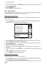
5. Move the cursor to the bottom right-hand corner of the area which you want to erase
marks and lines from.
6. Press the END soft key or the ENTER knob. You are asked if you are sure to delete the
marks/lines selected. Press the ENTER knob to delete.
7. Press the MENU key twice to close the menu.
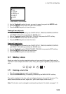
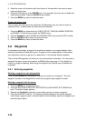
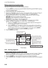
Erasing all marks, lines
You can erase all marks and lines collectively. Be absolutely sure you want to erase all
marks and lines - erased marks and lines cannot be restored.
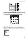
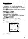
1. Press the MENU key followed by the CHART SETUP, TRACKS & MARKS CONTROL
and ERASE T & M soft keys to show the ERASE menu.
2. Use the Trackball to select ERASE ALL MARKS/LINES, then press the EDIT soft key.
3. Push the ENTER knob to erase all marks and lines.
4. Press the MENU key twice to close the menu.
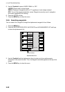
3.8 Waypoints
In navigation terminology, a waypoint is a particular location on a voyage whether it be a
starting, intermediate or destination point. A waypoint is the simplest piece of information
your equipment requires to get you to a destination, in the shortest distance possible.
This unit has 999 waypoints into which you can enter position information. You may enter a
waypoint five ways: at own ship position, at MOB position (see page 1-13 for details), by
cursor, by range and bearing, and through the waypoint list (manual input of latitude and
longitude).
3.8.1 Entering waypoints
Entering a waypoint at own ship position
Press the SAVE/MOB key momentarily to store your position as a waypoint. This new
waypoint is saved to the waypoint list, under the youngest empty waypoint number.
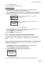
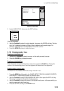
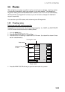
Entering a waypoint with the cursor
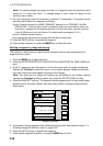
1. Press the MENU key to open the menu.
2. Press the WAYPOINTS/ROUTES, WAYPOINTS and WAYPOINT BY CURSOR soft
keys. The plotter display appears.
3. Operate the Trackball to place the cursor where you want to enter a waypoint.
4. Press the NEW WPT soft key. The waypoint window appears and it shows waypoint
mark shape, waypoint name, comment (default: time and date), position of waypoint and
proximity alarm radius.