


SP - 4 E3543S01D
110318
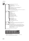
4.6 Output Data
Alarm signal 12 VDC, 100 mA or less
NMEA 0183 Ver1.5 GGA, GLL, RMA, RMC, GTD, VTG, ZDA (GPS data required)
RMB, WPL, BWC or BWR, APB, AAM, BOD, XTE, VHW, MTW,
DPT or DBT, DBS (ETR required),
TLL (L/L, Heading data required), TTM (ARPA required)
5 PLOTTER FUNCTION
5.1 Projection Mercator
5.2 Usable Area 85 latitude or below
5.3 Effective Area 211.2 x 158.4 mm
5.4 Display pixels 640 x 480 dots
5.5 Position Indication Latitude/longitude, Loran C LOP or DECCA LOP
5.6 Effective Projection Area 0.125 nm to 1,024 nm (at equatorial area)
5.7 Track Display Plot interval: by time (1 sec. to 99 min. 59 sec.) or
by distance (0 to 99.9 nm)
5.8 Colors Red, yellow, green purple, light-blue, blue, white
5.9 Memory Capacity Track/mark: 8000 points, Waypoint: 999 points
5.10 Storage Capacity Simple route: 200 routes with 35 waypoints each
5.11 MOB 1 point
5.12 Quick Routes 1 course with 35 waypoints max.
5.13 Electronic Chart SD card - FURUNO or NAVIONICS chart card available
C-MAP chart card also available
5.14 Alarms Arrival and Anchor watch, Cross track error and proximity
alarms, Ship’s speed in and out alarms, Water temperature,
Trip alarm, Fish alarm, Bottom alarm (ETR required), Grounding
alarm
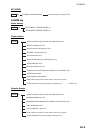
6 POWER SUPPLY
6.1 Rated Voltage/Current
M1824C 12-24 VDC: 6.9-3.5 A
M1834C 12-24 VDC: 6.5-3.2 A
M1934C 12-24 VDC: 7.9-3.8 A
M1944C 12-24 VDC: 8.3-4.0 A
M1954C (24rpm) 12-24 VDC: 9.6-4.8 A
M1954C (48 rpm) 12-24 VDC: 11.4-5.6 A
M1964C (24rpm) 12-24 VDC: 11.5-5.7 A
M1964C (48rpm) 12-24 VDC: 13.2-6.3 A
6.2 Rectifier (option) 100-115/220-230 VAC, 1 phase, 50/60 Hz