


12. User Chart Control
12-11
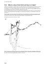
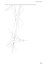
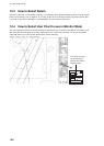
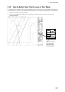
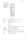
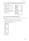
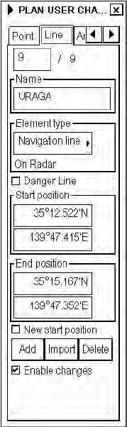
12.6.3 Line page
The Line page lets you
inscribe lines on a user chart.
To choose this page, push the
right mouse button (Next
Card), click the tab with the
left mouse button or hit the
NEXT key on the keyboard-
equipped control unit
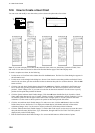
Enable changes:
Check in order to modify user chart.
Note: The user chart may only be modified in the Course-up or North-up mode.
Line box:
Shows the current and total number of line points.
Name:
Permits naming of current line.
Element type:
User can choose appropriate line type from combo box. Available types are:
• Navigation line
• Route line
• Depth contour
• Coast line
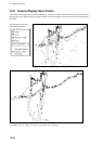
Navigation and route lines may also be displayed on the Radar screen. Depth contours and
coastlines are visible only on the chart radar display.
Danger Line:
Check to use line in chart alert calculation.
Start position:
Manually enter starting latitude and longitude in this box.
End position:
Manually enter ending latitude and longitude of line in this box.
New start position:
Check to draw a new line. If unchecked, any newly entered line will be connected to
previous line.
Add:
This function adds new record next to current record. User can either edit position by
entering new co-ordinates or by showing new location with the trackball and left button.
Import:
Choose a user chart from which to import lines.
Delete:
This function deletes current record of line.