


GPS AND CARTOGRAPHY
(with 937c DF Combo and 937c Combo models only)
The 937c DF Combo and 937c Combo models use GPS and sonar to determine your
position, display it on a grid, and provide detailed underwater information. The Global
Positioning System (GPS) is a satellite navigation system designed and maintained by
the U.S. Department of Defense. GPS was originally intended for military use; however,
civilians may also take advantage of its highly accurate position capabilities, typically
within +/- 10 meters, depending on conditions. This means that 95% of the time, the
GPS receiver will read a location within 10 meters of your actual position. The GPS
Receiver also uses information from WAAS (the Wide Area Augmentation System),
EGNOS (the European Geostationary Navigation Overlay Service), and MSAS (the
MTSAT Satellite Augmentation System) satellites if they are available in your area.
GPS uses a constellation of satellites that continually send radio signals to the earth.
Your present position is determined by receiving signals from up to 12 satellites and
measuring the distance from the satellites. The GPS Receiver, when attached to your
937c DF Combo or 937c Combo model, allows you to combine easy-to-use FishingGPS™
chartplotter and navigation capabilities with advanced fishfinding. The following GPS
functionality is currently supported by the 937c DF Combo and 937c Combo models
when it is connected to a GPS Receiver:
• View current position
• View current track (breadcrumb trail)
• View precision speed and heading from your GPS receiver
• Save tracks, waypoints and routes
• Travel a route and navigate from one waypoint to the next.
NOTE: Only the 937c DF Combo and 937c Combo models support Navionics® Gold Charts
marine cartography and Navionics® HotMaps™ 2004 Gold for inland fishing. The 900
Series™ does not support Navionics® Classic Charts.
The 937c DF Combo and 937c Combo models also come with a built-in World map with a
more detailed map of North America (Domestic models) or a more detailed map of
Europe and Southeast Asia, including Australia and New Zealand (International models).
Your 937c DF Combo and 937c Combo models use the GPS Receiver to determine the
position of the boat automatically, and uses the zoom level settings on a particular
view to select the best chart to display. See Viewing Cartography for more information.
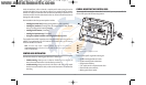
MULTI-MEDIA CARD (MMC)/SD SLOT
The 900 Series™ 937c DF Combo and 937c Combo models
support cartography, and have two multi-media card
(MMC)/SD slots. Optional-purchase MMC and/or SD cards
can contain additional detailed maps. You can also export
navigation data from your unit onto an MMC/SD card (see
Navigation Main Menu: Export All Nav Data). If you insert
an MMC or SD card that contains a more detailed chart for
a particular location, your unit will retrieve that chart and
display it automatically.
931c DF and 931c models have one MMC/SD slot and do
not support cartography.
On any model, use the MMC/SD cards to update the software version of your control
head. To update the software in your control head, plug in the appropriate MMC/SD
card that contains a software update file; the unit will recognize it, will tell you what
software version your control head is currently running, and will ask you if you want to
update the software in the unit to match that on the MMC/SD card. You can obtain
software updates from the www.humminbird.com website.
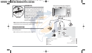
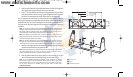
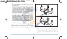
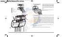
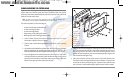
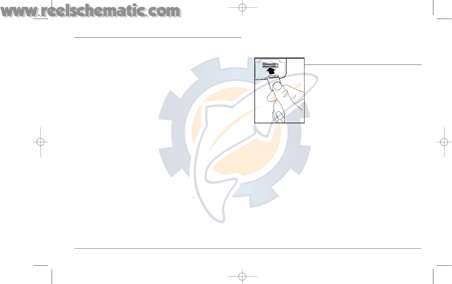
Use the illustration to locate the position of the MMC and SD slot cover, remove the
cover, and then insert an MMC and/or an SD card into one or both slots - either slot
can accept either an MMC or an SD card. The label on both types of cards should face
down and away from you so that you’re looking at the back of the card. Press down
on the card until it clicks into place, then replace the slot cover and tighten the screw
snugly - do NOT overtighten, as this will not improve water resistance, and may
damage the cover.
Multi-Media Card
(MMC/SD) Slot
2
93x_Man_531370-1_A - vs4.qxd 2/18/2005 11:11 AM Page 7