


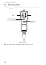
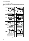
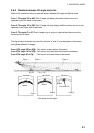
2. HORIZONTAL MODE
2-2
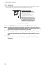
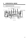
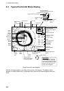
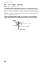
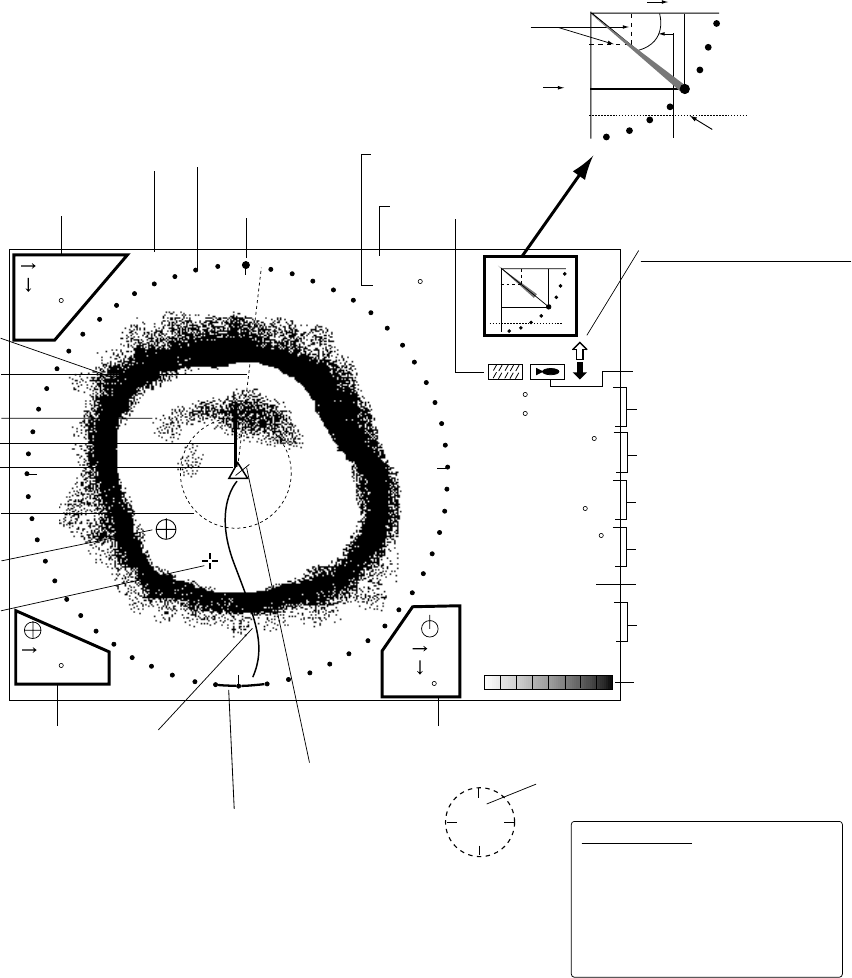
2.2 Typical Horizontal Mode Display
25
R 40 m
T 40
16
13
B208
+
CSE 357
SPD 9.9 kt
DEP 35 m
TMP 12.3 C
CUR 11.0˚
2.0 kt
GAIN 5.3
TVG LEVEL 4.0
DISTANCE 200 m
COLOR
34 12. 343' N
134 34. 213' W
9
8
B7
16
B234
Cursor data
Train indicator
Sector marker
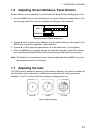
Range
Tilt angle
Tilt angle indicator
(Indicates transducer tilt angle.)
30
25
Horizontal max. range
Vertical max.
depth
Tilt angle
Own ship
marker
ETA marker
Fish echo
Bottom
echo
Range
marker
Bearing
marker
Event
marker
Cursor
Event
marker
data
Ship's
track*
Range and bearing
markers data
Current
vector*
Target lock indicator
Interference
rejector
Position in latitude*,
longitude*
Course*, speed*
Depth,
water temperature*
Tide direction*,
tide speed*
Gain setting
TVG level,
distance settings
Color bar
CUR 11.0
2.0 kt
* Requires appropriate
sensor.
Depth marker
(See note
below.)
Range and bearing markers
Depth marker
When depth data is input from
external equipment, the depth
marker shifts according to depth
data. If the depth data is greater
than the horizontal range, the
depth marker disappears.
(DEMO)
Demonstration
mode
N
S
W
E
S
E
N
W
North marker*
30
Transducer status indicator
Filled arrow: Respective
action completed
Blinking arrow: Action in
progress
Sweep indicator
(Shows train position
in horizontal mode.)
Typical horizontal mode display
With the tilt angle lowered, your ship is at the center of the screen. The bottom, which
appears in reddish-brown color, is displayed as a circle and fish echoes appear within the
circle.