


6 GPSMAP
®
4000/5000 Series Owner’s Manual
Using Charts
Using
Charts
Using Charts
Your unit has a basic worldwide imagery map. By purchasing an optional Blue Chart g2 Vision
preprogrammed SD card, you can view detailed information for your region, including:
Navigation Chart—displays navigation data, including buoys, lights, cables, depth soundings,
marinas, and tide stations in an overhead view.
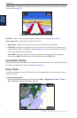
Mariner’s Eye 3D—displays a view from above and behind your boat for a visual navigation
aid.
Fish Eye 3D—an underwater view that visually represents the sea oor according to the
information on the chart.
Fishing Chart—removes navigational data from the chart and enhances bottom contours for
depth recognition.
The unit automatically shows relevant navigational data when you select a navigation option.
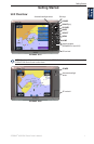
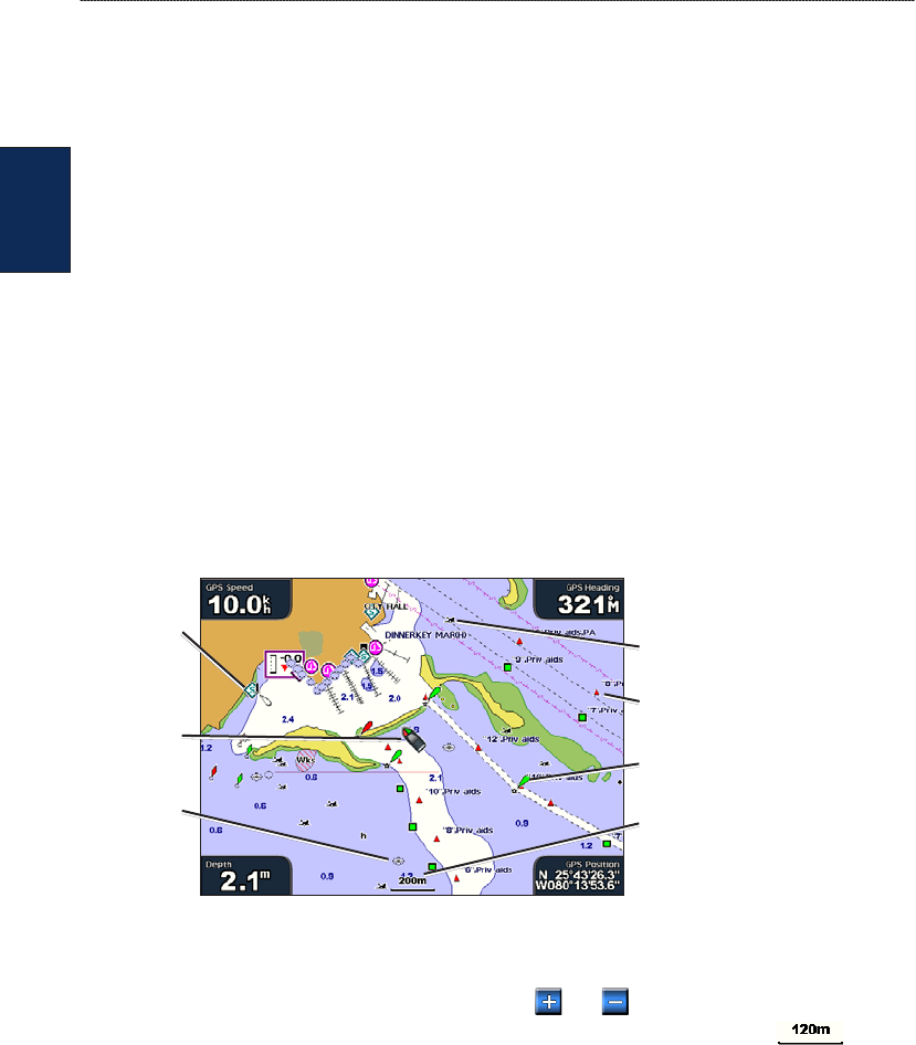
Using the Navigation Chart
Use the Navigation chart to plan your course, to view map information, and as a navigational aid.
To access the Navigation chart, from the Home screen, select Charts > Navigation Chart.
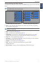
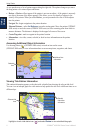
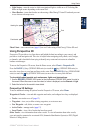
Navigation Chart with BlueChart g2 Vision Data
Buoy
Beacon
Your boat
Exposed
wreck
Marine
services
Zoom scale
Submerged
wreck
Zooming In and Out on the Map
The RANGE (+/-) keys (GPSMAP 4000 series) or the and keys (GPSMAP 5000 series)
control the zoom level, indicated by the scale at the bottom of the Navigation chart ( ). The
bar under the number represents that distance on the map.
Navigation Chart Menu
To access additional settings or options for the Navigation chart, select Menu.
Waypoints & Tracks
—view and add waypoints and tracks, and congure how they are displayed.
Other Vessels—view information about other vessels. To view information about other vessels,
your unit must be connected to an external AIS (Automatic Identication System) or DSC (Digital
Selective Calling) device.
Stop Navigation—stop navigating to your destination (only available while navigating).
Chart Setup—customize the Navigation chart settings (page 9).
•
•
•
•