


GPSMAP
®
4000/5000 Series Owner’s Manual 33
Conguring the Chartplotter
Conguring the
Chartplotter
Conguring Units of Measure
To change units of measure from the Home screen, select Congure > Preferences > Units.
System Units—global setting that denes individual units of measure at the same time. Statute
(mh, ft, ºF), Metric (kh, m, ºC), Nautical (kt, ft, ºF), or Custom. Select Custom to individually
dene units of measure for depth, temperature, distance, speed, elevation, volume, and pressure.
NOTE: You must be receiving NMEA sonar depth data or using a Garmin sounder module to view
depth and water temperature information.
Heading—sets the reference used in calculating heading information.
Auto Mag Var—Automatic Magnetic Variation automatically sets the magnetic declination for
your location.
True
—sets true north as the heading reference.
Grid—sets grid north as the heading reference (000º).
User Mag Var—allows you to set the magnetic variation value.
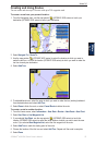
Position Format—change the coordinate style in which a given location reading appears. Do not
change the position format unless you are using a map or chart that species a different position
format.
Map Datum—change the coordinate system in which the map is structured. Do not change the Map
Datum unless you are using a map or chart that species a different Map Datum.
Time
—set the time options.
Time Format
—select 12-hour, 24-hour, or UTC time format.
Time Zone
—set the time zone you want displayed for time readings.
Daylight Saving Time
—indicate whether you want daylight saving time Off, On, or Auto. The
auto setting automatically turns daylight saving time on or off, depending on the time of year.
Conguring Communications Settings
To change the communications settings from the Home screen, select Congure >
Communications.
NMEA 0183 Setup—enable or disable NMEA 0183 output sentences for sounder, route, system,
and Garmin NMEA settings.
Port Types
—congure the input/output format for each port to use when connecting your
chartplotter to external NMEA devices, a computer, or other Garmin devices. NMEA Std.
supports the input or output of standard NMEA 0183 data, DSC, and sonar NMEA input support
for the DPT, MTW, and VHW sentences. NMEA High Speed supports the input or output of
standard 0183 data for most AIS receivers. The Garmin option supports the input or output of
Garmin-proprietary data for interfacing with Garmin software.
Posn. Precision—adjust the number of digits (Two Digits, Three Digits, or Four Digits) to the
right of the decimal point for transmission of NMEA output.
Waypoint IDs—determine how the unit outputs waypoint identiers (Names or Numbers).
Defaults—reset NMEA 0183 settings to their default settings (OK or Cancel).
Diagnostics—a tool used by installers to verify that NMEA 0183 data is being sent across the
system.
•
•
•
•
•
•
•
•
•
•
•
•