


GPSMAP
®
4000/5000 Series Owner’s Manual 7
Using Charts
Using
Charts
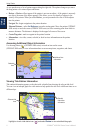
Understanding Chart Data
BlueChart g2 and BlueChart g2 Vision charts use graphic symbols to denote map features, which
follow the standards for US and international charts.
Other features common to most charts include depth contour lines (with deep water represented in
white), intertidal zones, spot soundings (as depicted on the original paper chart), navigational aids
and symbols, and obstructions and cable areas.
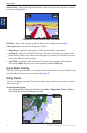
Navigating to a Point on the Chart
1. From the Home screen, select Charts.
2. Select Navigation Chart, Fishing Chart, or Radar Overlay.
3. Select the point on the chart to which you want to go.
4. Select Navigate To.
5. Select Go To (or Guide To when using a preprogrammed BlueChart g2 Vision card for Auto
Guidance).
6. Follow the colored line on the screen to the destination.
To create a route to a point on the chart, see page 25.
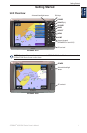
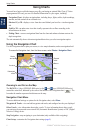
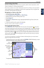
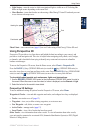
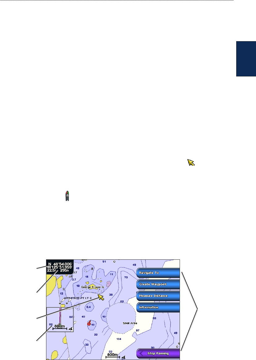
Panning the Navigation Chart
Use the ROCKER on your GPSMAP 4000 series unit to move the map pointer ( ) away from
your current location and to scroll to other areas on the Navigation chart. As you pan past the edge
of the current map display, the screen scrolls forward to provide continuous map coverage. Touch
and drag the Navigation screen on your GPSMAP 5000 series unit to pan away from your current
location. The position icon ( ) stays at your present location. If the position icon leaves the map
when you pan, a small window (inset map) appears on the left of the screen so that you can keep
track of your current position.
As you move the map pointer, its coordinates, distance, and bearing from your current location
appear in the upper-left corner of the map.
To pan the map, press up, down, right, or left on the ROCKER (GPSMAP 4000 series), or touch
and drag the Navigation screen (GPSMAP 5000 series).
Map
pointer
Inset
map
Pan
options
Pointer distance
and bearing
from current
location
Pointer
coordinates
To stop panning, select Stop Panning.