


32 GPSMAP
®
4000/5000 Series Owner’s Manual
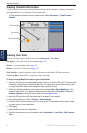
Conguring the Chartplotter
Conguring the
Chartplotter
Conguring the Chartplotter
Use the Congure screen to congure unit settings.
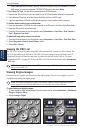
Conguring System Settings
To change general system settings from the Home screen, select Congure > System.
Simulator—turn Simulator Mode On or Off. Select Setup to set simulator options. (If you set the
unit into a Store Demonstration mode during the initial unit setup, this setting is named Demo.)
Auto Power Up (GPSMAP 4010 and GPSMAP 5015 only)—turn Auto Power Up On or Off. When
On is selected, the chartplotter will automatically turn on whenever power is applied, unless the
chartplotter is turned off with the Power key before power is lost.
Beeper/Display—select Beeper to set when the unit makes audible sounds. Select Backlight to
brighten or darken the backlight. Select Color Mode to switch between Day Mode and Night Mode.
Select Screenshot Capture to turn the screenshot capture feature on or off (page 54).
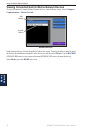
GPS—view GPS satellites.
System Information—view system information, reset factory settings, view the status of networked
devices, and display the event log. The event log displays a list of system events. Select the event
to view additional information. The Save to Card button is provided as a troubleshooting tool; a
Garmin Product Support representative may ask you to use this to retrieve data about the marine
network.
Radar Diagnostics (if radar is connected)—a troubleshooting tool used by installers.
Changing the System Language
To change the system language, from the Home screen, select Congure > Preferences >
Language and then select the language.
Conguring Navigation Preferences
To change navigation preferences, from the Home screen, select Congure > Preferences >
Navigation.
Route Labels—for saved routes, this determines whether route turns are indicated by number (Turn
1, Turn 2, and so on) or by waypoint name, or whether the description of turns is hidden.
Turn Transition
—set how much time or how far before a turn in a route that you transition to the
next leg. Raising this value can help improve the accuracy of the autopilot when navigating a route
or automatic-guidance line with many frequent turns or at higher speeds. For straighter routes or
slower speeds, lowering this value can improve autopilot accuracy.
Speed Sources—specify the sensor used for Wind numbers and Fuel Economy. Touch Wind or Fuel
Economy to toggle between Water (from a water-speed sensor) and GPS (from the calculated GPS
speed).