


GPSMAP
®
4000/5000 Series Owner’s Manual 15
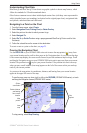
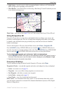
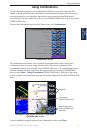
Using Charts
Using
Charts
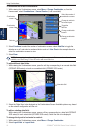
Press the RANGE (+) key (GPSMAP 4000 series) or touch the key (GPSMAP 5000 series) to
move the view closer to your boat and lower to the water. Press the RANGE (-) key (GPSMAP 4000
series) or touch the key (GPSMAP 5000 series) to move the view away from the boat.
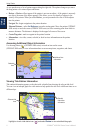
To view details about navaids such as beacons, lights, and obstructions:
1. Use the ROCKER (GPSMAP 4000 series) or the touchscreen (GPSMAP 5000 series) to point to
the navaid. When the cursor is over the navaid, a button is displayed, such as Beacon or Light.
2. Select the button for the navaid to view details.
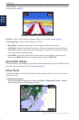
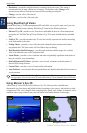
Mariner’s Eye 3D Settings
To access additional settings or options from the Mariner’s Eye 3D screen, select Menu.
For settings and options related to Waypoints & Tracks, Other Vessels, Surface Radar, and Data
Bars, see “Perspective 3D Settings” on page 11.
To customize the appearance of the Mariner’s Eye 3D screen, select Menu > Chart Appearance.
Style—Selects how chart data is displayed over 3D terrain.
Classic—uses color schemes to indicate 3D terrain.
Charts—provides chart information in a 3D view.
Photos—provides satellite photo imagery in addition to chart information.
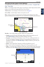
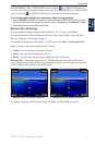
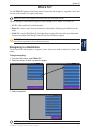
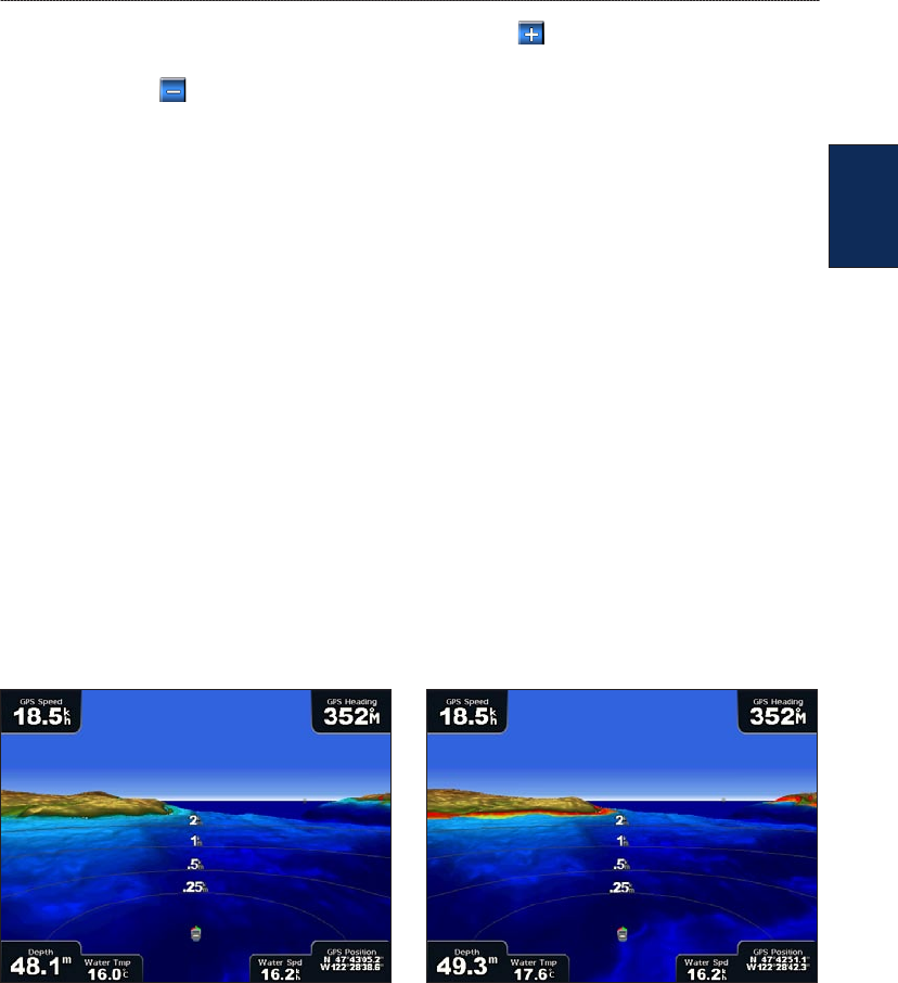
Hazard Colors—Turns hazard colors on or off. The Off setting shows the land as seen from the
water. The On setting indicates shallow water and land with a color scale. Blue indicates deep water,
yellow is shallow water, and red is very shallow water.
Mariner’s Eye 3D, Hazard Colors Off Mariner’s Eye 3D, Hazard Colors On
For settings and options related to Range Rings, Safe Depth, and Lane Width, see page 12.
•
•
•