


14 GPSMAP
®
4000/5000 Series Owner’s Manual
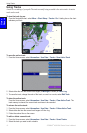
Using Charts
USinG
ChartS
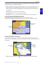
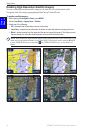
Enabling High-Resolution Satellite Imagery
You can overlay high-resolution satellite images on the land, the sea, or both portions of the
Navigation chart when using a preprogrammed BlueChart g2 Vision SD card.
To enable satellite imagery:
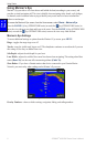
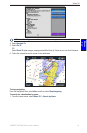
1. While viewing the Navigation Chart, press MENU.
2. Select Chart Setup > Appearance > Photos.
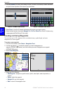
3. Select one of the following:
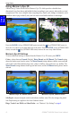
Off—standard chart information is shown on the map.
Land Only—standard chart information is shown on water with photos overlaying the land.
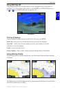
Blend—photos overlay both the water and the land at a specied opacity. The higher you set
the percentage, the more the satellite photos will cover both land and water.
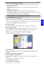
NOTE: When enabled, the high-resolution satellite images are present only at lower zoom levels. If you
cannot see the high-resolution images in your BlueChart g2 Vision region, zoom in using the RANGE
(+) key (GPSMAP 4000 series) or touch the key (GPSMAP 5000 series), or set the detail level
higher.
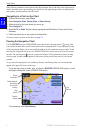
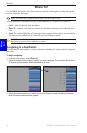
Blend at 50%
Blend at 100%
Photo Overlay Off Land Only Photo Overlay
•
•
•