


GPSMAP
®
4000/5000 Series Owner’s Manual 29
Conguring the Chartplotter
ConfiGUrinG the
Chartplotter
Conguring the Chartplotter
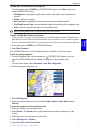
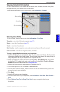
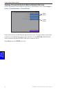
Use the Congure screen to congure unit settings.
Conguring System Settings
To change general system settings from the Home screen, select Congure > System.
Simulator—turn Simulator Mode On or Off. Select Setup to set simulator options. (If you set the
unit into a Store Demonstration mode during the initial unit setup, this setting is named Demo.)
Language—select the on-screen language.
Auto Power Up (GPSMAP 4010 and GPSMAP 5015 only)—turn Auto Power Up On or Off. When
On is selected, the chartplotter will automatically turn on whenever power is applied, unless the
chartplotter is turned off with the Power Key before power is lost.
Beeper/Display—select Beeper to set when the unit makes audible sounds. Select Backlight to
brighten or darken the backlight. Select Color Mode to switch between Day Mode and Night Mode.
GPS—view GPS satellites, turn WAAS/EGNOS on or off, select the source of GPS signals, and
set the speed lter to On, Off, or Auto. The speed lter averages the speed of your boat over a short
period of time for smoother speed values.
System Information—view system information, restore factory settings, view the status of
networked devices, and display the event log. The event log displays a list of system events. Select
the event to view additional information.
Overlay Numbers—view or edit the options for Wind (Apparent Wind or True Wind) and Next
Turn numbers (Distance or Time) for routes.
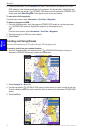
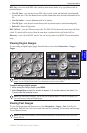
Changing Units of Measure
To change units of measure from the Home screen, select Congure > Units.
System Units—global setting that denes individual units of measure at the same time. Statute
(mh, ft, ºF), Metric (kh, m, ºC), Nautical (kt, ft, ºF), or Custom. Select Custom to individually
dene units of measure for depth, temperature, distance, speed, elevation, volume, and pressure.
NOTE: You must be receiving NMEA sonar depth data or using a Garmin sounder module to view
depth and water temperature information.
Heading—sets the reference used in calculating heading information.
Auto Mag Var—Automatic Magnetic Variation automatically sets the magnetic declination for
your location.
True—sets true north as the heading reference.
Grid—sets grid north as the heading reference (000º).
User Mag Var—allows you to set the magnetic variation value.
Position Format—change the coordinate style in which a given location reading appears. Do not
change the position format unless you are using a map or chart that species a different position
format.
Map Datum—change the coordinate system in which the map is structured. Do not change the Map
Datum unless you are using a map or chart that species a different Map Datum.
•
•
•
•