


GPSMAP
®
4000/5000 Series Owner’s Manual 31
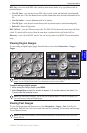
Conguring the Chartplotter
ConfiGUrinG the
Chartplotter
3. Select an alarm.
4. Select On to turn the alarm on, and then specify alarm information.
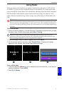
Setting Navigation Alarms
To set a navigation alarm, from the Home screen, select Congure > Alarms > Navigation.
Anchor Drag—set an alarm to sound when you exceed a specied drift distance.
Arrival—set an alarm to sound when you are within a specied distance or time from a destination
waypoint.
Off Course—set an alarm to sound when you are off course by a specied distance.
Setting System Alarms
To set a system alarm, from the Home screen, select Congure > Alarms > System.
Clock—set an alarm using the system (GPS) clock. The unit must be on for the clock alarm to work.
Battery—set an alarm to sound when the battery reaches a user-determined low voltage.
GPS Accuracy—set an alarm to sound when the GPS location accuracy falls outside the user-
determined value.
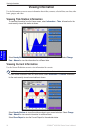
Setting Sonar Alarms
To set a sonar alarm, from the Home screen, select Congure > Alarms > Sonar.
NOTE: You must have an optional sonar module (and a transducer connected to the sounder module)
wired through NMEA 0183 or connected to the Garmin Marine Network to receive sonar information.
Shallow Water/Deep Water—set an alarm to sound when the depth is less than or greater than the
specied value.
Water Temp—set an alarm to sound when the transducer reports a temperature that is 2°F (1.1°C)
above or below the specied temperature.
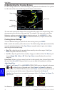
Fish—set an alarm to sound when the unit detects a suspended target of the specied symbols.
— sounds an alarm for all sh sizes
— sounds an alarm for medium and large sh only
— sounds an alarm for large sh only
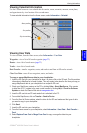
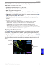
Conguring My Boat
To congure settings for your boat, from the Home screen, select Congure > My Boat.
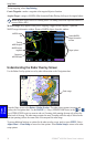
Auto Guidance—set the Auto Guidance parameters for your boat:
Safe Depth—set the minimum depth (chart depth datum) to allow when calculating an auto
guidance path. A safe depth of less than one meter is not allowed when using Auto Guidance.
Safe Height—set the minimum height (chart height datum) of a bridge that your boat can safely
travel under.
Keel Offset—offset the surface reading for the depth of a keel, making it possible to measure depth
from the bottom of the keel instead of from the transducer location. Enter a positive number to offset
for a keel. Enter a negative number to offset for a large vessel that may draw several feet of water.
•
•