


GPSMAP
®
4000/5000 Series Owner’s Manual 3
Getting Started
GettinG
Started
To adjust the color mode:
1. Press and release the Power key.
2. Select Color Mode.
3. Select Day Colors, Night Colors, or Auto.
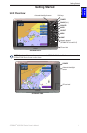
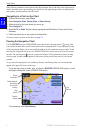
Acquiring GPS Satellite Signals
When you turn the unit on, the GPS receiver must collect satellite data and establish its current
location. When the unit acquires satellite signals, the signal strength bars at the top of the Home
screen are green . When the unit loses satellite signals, the green bars disappear and the
position icon shows a ashing question mark.
For more information about GPS, visit the Garmin Web site at www.garmin.com/aboutGPS.
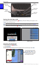
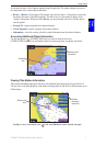
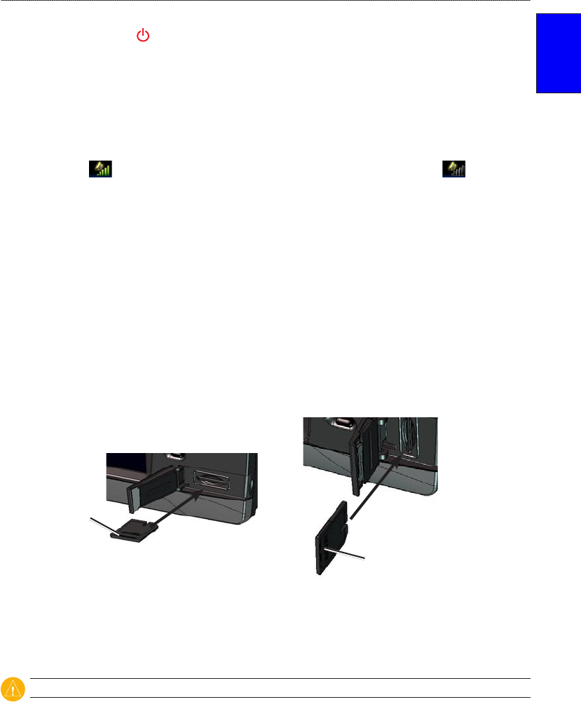
Inserting and Removing SD Cards
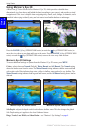
Your unit supports Secure Digital (SD) cards. Insert optional BlueChart
®
g2 Vision™ SD cards to
view high-resolution satellite imagery, and aerial reference photos of ports, harbors, marinas, and
other points of interest. Insert blank SD cards to transfer data such as waypoints, routes, and tracks
to another compatible Garmin unit or a computer. The SD card slot is located on the lower-right
corner of the unit.
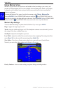
To insert the SD card, open the access door and press the SD card in until it clicks. Press the card in
again and release it to eject it from the chartplotter.
Card label
GPSMAP 4010 and 4012
Card label
GPSMAP 4008 and 5000 series
Restoring Factory Settings
You can restore your unit to the original factory settings.
CAUTION: This procedure deletes any information you have entered.
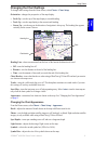
To restore factory settings:
1. From the Home screen, select Congure > System > System Information.
2. Select Factory Settings.
3. Select Reset to restore all factory settings or select Back to cancel.
Viewing System Information
You can view the software version, basemap version, and unit ID number for your chartplotter.
You may need this information to update the system software or to purchase additional map data
information.
From the Home screen, select Congure > System > System Information.