


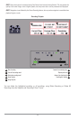
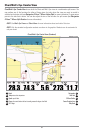
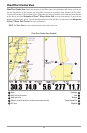
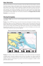
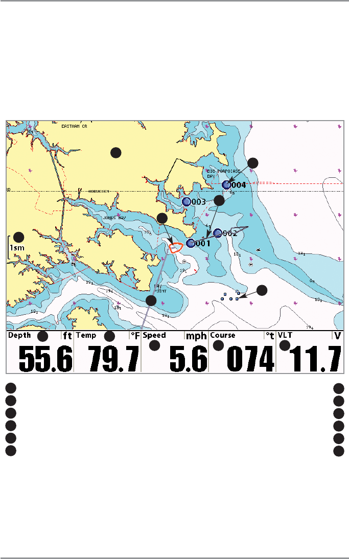
Chart View
Chart Views - The standard Chart, Chart No Readouts, and Chart/Chart Combo Views, as well as the Chart
side of the Chart/Bird's Eye Combo View and the Chart/Bird's Eye Combo Instrument View, all show
cartography from the built-in UniMap™ or an optional MMC/SD map for the area surrounding your current
position. The current track (also known as the position history or breadcrumb trail) showing where the boat
has been, along with saved tracks, waypoints, and the current route (when navigating), are overlaid on the
chart. You can use the 4-WAY Cursor Control key to shift/pan the chart to another area. You can use the
ZOOM (+/-) keys to zoom in and out. You can use the INFO key to get information on the chart objects near
the cursor as well as to view Screen Snapshots.
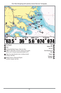
Decluttered Waypoints: Small blue icons with hidden waypoint names that replace regular waypoint
icons as you zoom out. All waypoint icons that might otherwise overlap each other as you zoom out
change into these small blue icons to help screen readability.
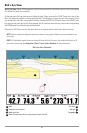
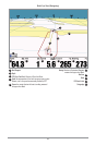
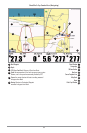
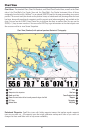
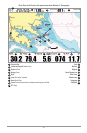
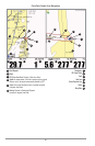
Chart View (Standard) with optional-purchase Navionics® Cartography
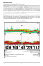
1
2
3 4
Depth
1
Temp:
water surface temperature
2
Speed:
speed of boat
3
Course:
the current direction the boat is traveling measured in degrees from North
4
VLT:
Voltage
5
Declutter Icons
6
5
Track
7
Boat Icon
8
Course Projection Line
9
Waypoint
10
Cartography
11
Map Scale
12
6
7
12
11
8
9
10
86