


Page 71CPV350
14. ADVANCED SETTINGS
The Advanced Setup menu allows customization of many GPS functions, Alarms and
NMEA interfacing.
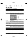
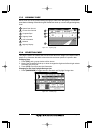
1. To access this menu press [MENU] two times. Move the ShuttlePoint knob to highlight
ADVANCED SETUP and press [ENT]or move the ShuttlePoint knob to the right.
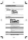
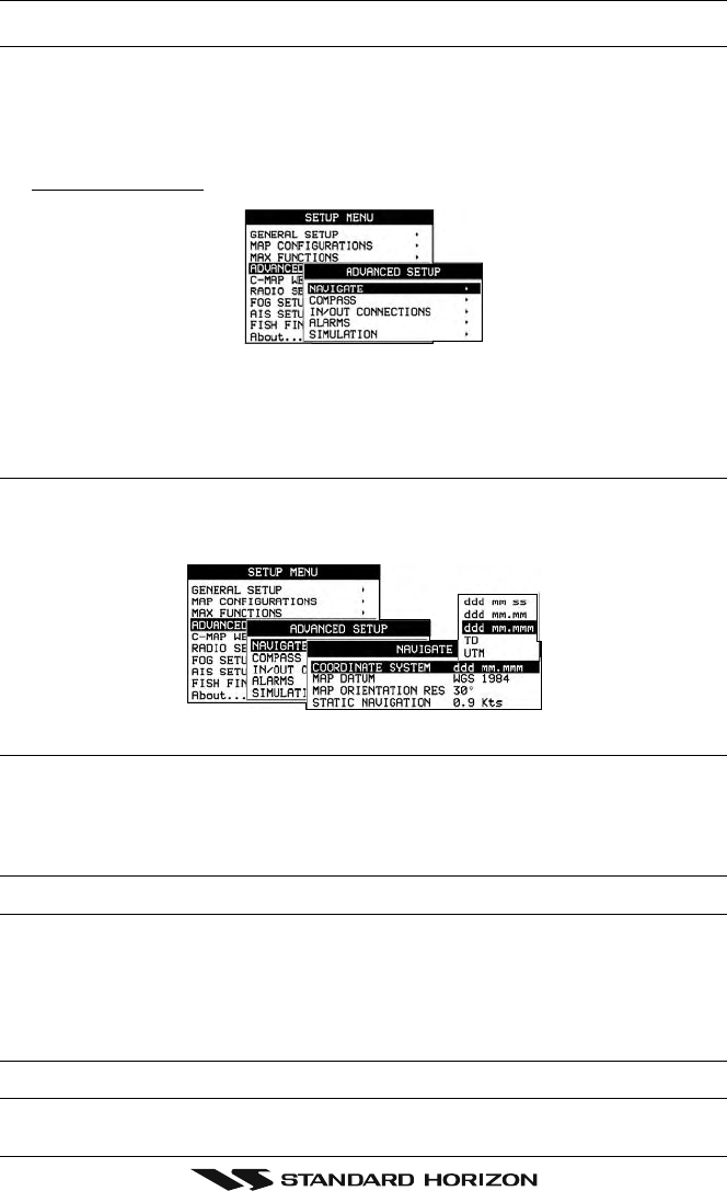
Figure 14 - Advanced Settings Menu
While in this menu you will see many selections which are described in the next sections.
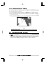
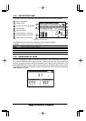
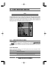
14.0 NAVIGATE
The Navigate Menu allows customization of the Coordinate System (Loran TD’s), Map
Datum, Map Orientation Resolution (angle the vessel has to change before the chart is
redrawn) and Static Navigation.
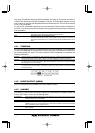
Figure 14.0 - Navigate Menu
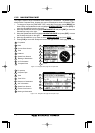
Coordinate System : Selections are:
a. TD: Loran TD
b. UTM: Universal Transverse Mercator Grid
c. ddd mm.mmm:Degrees Minutes and Thousands of Minutes
d. ddd mm.mm: Degrees Minutes and Hundredths of Minutes
e. ddd mm.ss: Degrees Minutes and Seconds (default)
Map Datum : Allows selection of Map Datums. The default Datum is WGS84 as C-MAP cartography
has been compiled using the WGS84 Datum.
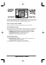
Map Orientation Resolution: Sets the angle the vessel has to change before the chart is redrawn. The default setting
is 30 degrees. Example: if the vessel is heading 000T at a speed of 25 Knots, the display
will redraw:
a. In Home mode the GPS chartplotter centers the location of the vessel in the center
of the display. To keep the vessel in the center of the display the GPS chartplotter
will occasionally redraw.
b. If the vessel changes course greater than 330T or more than 30T the chart will be
redrawn.
Static Navigation : Sets up a threshold for the speed. When the speed received from the positioning device
is under that threshold, the GPS chartplotter displays zero. The default setting is 0.9 Kts.