


97
and more than 60,000 navigation aids with 10,000 wrecks and
obstructions in U.S. coastal and Great Lakes' waters.
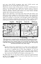
MapCreate custom maps include massive amounts of information not
found in the background map. MapCreate contains: Points of Interest
database, all the minor roads and streets, all the landmark features
(such as summits, schools, radio towers, etc.); more rivers, streams,
smaller lakes and ponds and their names.
What's more important is the large-scale map detail that allows your
GPS unit to show a higher level of position accuracy. For example, the
background map will show you the general outline and approximate
shape of a coastline or water body, but the higher detail in MapCreate
shows the shoreline completely and accurately. Many smaller islands
would not be included in the background map, but are in MapCreate.
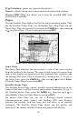
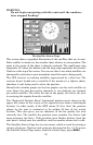
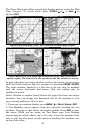
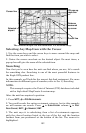
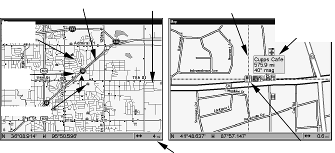
When the map is zoomed out far enough, most POIs appear as square
dots (left). As you zoom in closer, the symbols become readable icons.
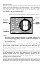
In the 0.6-mile zoom example (right), the cursor has selected the Cupps
Café POI, which triggers a pop-up box with the POI name. This pop-up
box works on POIs at any zoom range.
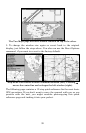
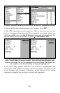
Tip:
In some urban areas, businesses are so close to one another their
POI icons crowd each other on the screen. In the preceding figure,
you can see a jumbled pile of POIs along Highway 34. You can
reduce screen clutter and make streets and other map features
easier to see by turning off the display of undesired POIs. (To see
how, check out the Map Detail Category section, page 141.)
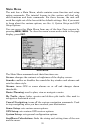
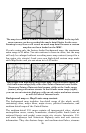
The Map Page has its own menu, which is used for several functions
and for setting various options. To access the Map Page Menu, from the
Map Page, press
MENU.
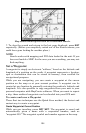
School POI
POI Pop-up,
with position,
distance and
bearing data
Restaurant
POI
POI
Mar
k
er
Cursor line
Interstate
Major Street
Minor
Streets
Zoom Range