


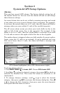
133
NOTE: When the position format is changed, it affects the way all
positions are shown on all screens. This includes waypoints.
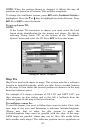
To change the coordinate system, press
ENT while COORDINATE SYSTEM is
highlighted. Press the ↑ or ↓ keys to highlight the desired format. Press
ENT. Press EXIT to close the menu.
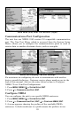
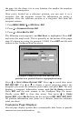
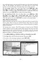
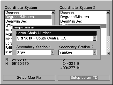
To set up Loran TD:
NOTE:
If the Loran TD conversion is chosen, you must enter the local
Loran chain identification for the master and slaves. Do this by
selecting "Setup Loran TD" at the bottom of the "Coordinate
System" menu and select the ID. Press
EXIT to close this menu.
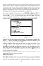
Configure Loran TD menu.
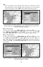
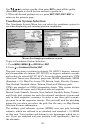
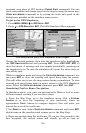
Map Fix
Map Fix is used with charts or maps. This system asks for a reference
position in latitude/longitude, which you take from a marked location
on the map. It then shows the present position as distance on the map
from that reference point.
For example, if it shows a distance of UP 4.00" and LEFT 0.50", you
then measure up four inches and to the left a half-inch from the
reference point on the map to find your location.
To configure a map fix:
To use this format, you need to follow these steps in order. First, take
your map of the area and determine a reference latitude/longitude.
(Please note that in order for this system to work, the
latitude/longitude lines must be parallel with the edge of the map.
USGS maps are parallel, others may not be. Also, this works better
with smaller scale maps.) The reference position can be anywhere on