


142
To correct this problem, Track-up Mode rotates the map as you turn.
What you see on the left side of the screen should always be to your left,
and so on.
Another option is course-up mode, which keeps the map at the same
orientation as the initial bearing to the waypoint. When either the
track-up or course-up mode is on, a "N" shows on the map screen to
help you see which direction is north.
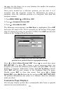
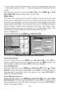
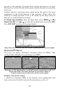
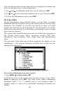
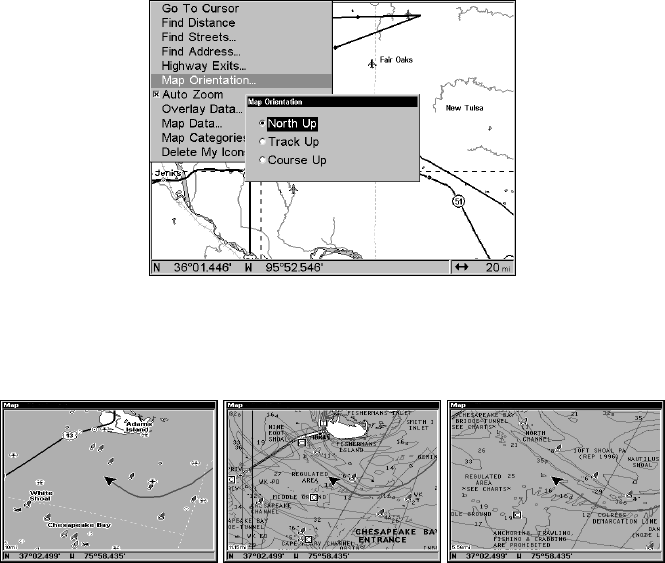
To change map orientation: from the Map Page, press MENU|↓ to MAP
ORIENTATION|ENT. Use ↑ or ↓ to select the desired mode, then press ENT.
Press
EXIT|EXIT to return to the page display.
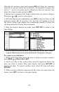
Map Orientation menu with the North Up map option selected (right).
Navionics
Charts
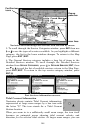
Your unit can display Navionics
electronic charts on MMCs. They
work just like a MapCreate custom map on a MMC.
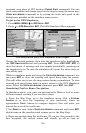
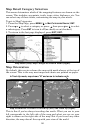
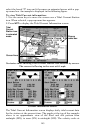
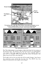
Entrance to Chesapeake Bay in a MapCreate 6 custom map with a 15-
mile zoom (left). The same position on Navionics chart at
10-mile zoom (center) and with a 5-mile zoom (right).
Display a Navionics chart:
1. Install the Navionics MMC in the memory card compartment and
turn on the unit. (For full card install instructions, see Sec. 2.)