


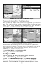
139
Fill Water with White
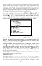
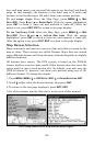
From the Map Page, press
MENU|↓ to MAP DATA|ENT. Press ↓ to FILL
WATER WITH WHITE. With the option highlighted, press ENT to check it
(turn on) and uncheck it (turn off.) After the option is set, press
EXIT|EXIT to return to the page display.
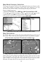
Trackline Extension
Trackline Extension is a new tracking option that provides a visual
interpretation of your velocity. It charts how long it will take to travel a
predetermined distance based on your current navigational
information. Distance is shown on one side of the track with estimated
time of arrival on the other. Below the Trackline Extension window are
two check boxes — Show Time and Show Distance — which allow you
to turn on or off the time and/or distance settings.
To set trackline extension: From the Map Page, press
MENU|↓ to
MAP DATA|ENT. Press ↓ to TRACKLINE EXTENSION|ENT. Use ↑ ↓ to select the
desired distance setting and press
ENT.
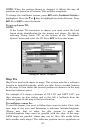
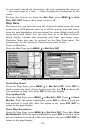
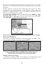
Presentation Mode
From the Map Page, press
MENU|↓ to MAP DATA|ENT. Press ↓ and → to
PRESENTATION MODE|ENT. Use ↑ ↓ to choose the desired depth and press
ENT. PRESENTATION MODE gives you some control over the map layout by
allowing you to choose between US and International Modes
.
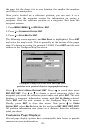
Safety Contour
From the Map Page, press
MENU|↓ to MAP DATA|ENT. Press ↓ and → to
SAFETY CONTOUR|ENT. Use ↑ ↓ to choose the desired depth and press ENT. The
SAFETY CONTOUR command allows you to modify depth contours on a
navionics map for water less than 10 meters deep. Based on your
preferences, the depth contours will be colored or shaded to make it
easier to identify shallow areas. Keep in mind the size of your ship's
keel when determining which option is right for your vessel.
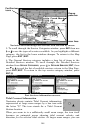
Map Overlays (Range Rings; Lat/Long Grid)
The map screen can be customized with four range rings and/or grids
that divide the plotter into equal segments of latitude and longitude.
Range rings are handy for visually estimating distances on the map.
The ring diameters are based on the current zoom range. For example:
at the 100-mile zoom, the screen will show two rings with your current
position in the center. The large ring touching the left and right sides of
the screen is 100 miles in diameter (same as the zoom range). The
second smaller ring is 50 miles in diameter (always 1/2 the zoom
range). The distance from your current position to the smaller ring (the
ring's radius) is 25 miles (always 1/4 the zoom range). With the arrow