


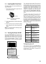
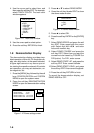
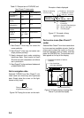
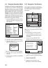
2-4
NAVAID: /FL 6S 12M
FROM OS 52.38nm 48.0°
Period (ex.: 6 seconds)
Visibility in nautical
mile (ex.: 12 miles)
FL : Flashing
F : Fixed light
F FL : Fixed and Flashing light
MO : Morse code light
Oc : Occulting light
Example of data displayed
Range and bearing
from own ship
Figure 2-7 Example of buoy,
lighthouse data
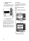
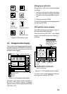
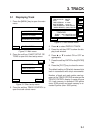
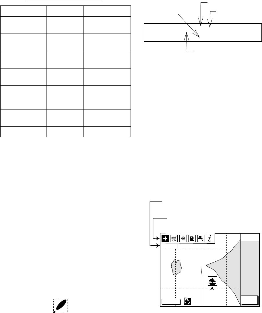
Port service icons (Nav-Charts™
cards)
Selected Nav-Charts™ mini chart cards show
by icons services available at ports. Use the
cursor pad to place the cursor on the sail-
boat icon (denotes a port or harbor), and then
press the [ENTER] key. The services avail-
able appear at the top of the display.
DGPS 3D
CANCEL
NORTH
UP
FIRST AID
Sailboat mark (Port)
Detailed information of service
selected
List of services
at the port selected
Figure 2-8 Plotter display showing Nav-
Charts™ port service display
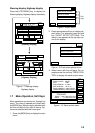
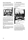
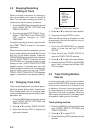
Table 2-3 Comparison of FURUNO and
Nav-Charts™ chart cards
metIONURUF ™strahC-vaN
gnillorcstoD
ytilibapac
SEYSEY
pu-esruoC
yalpsid
SEYSEY
atadesuohthgiL
noitatneserp
3*SEYSEY
rosructamooZ
noitisop
SEY1*
taegnaR
rotauqE
,5.0,521.0
8402...2,1
mn
tfelsaemaS
tesffotrahC
yrtneatad
SEYSEY
gniretneCSEY2*
*1 Nav-Charts™ chart may not center the
cursor perfectly.
*2 Nav-Charts™ chart may not center own
ship's position perfectly.
*3 Newly designed chart cards containing
lighthouse data. Chart cards for North
America area are completed, and others
are in production.
*4 Nav-Charts™ is the resistered trademark
of NAVIONICS INC.
Aid to navigation data
Selected FURUNO and Nav-Charts™ mini
chart cards can show buoy and lighthouse
data. Simply place the cursor on the light-
house or buoy mark.
Place the cursor on
a lighthouse or buoy mark.
Figure 2-6 Placing the cursor on the mark