


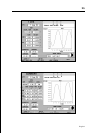

21
English
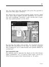
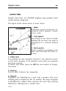
lect one object from this window and press the joystick to
show all of the object attributes.
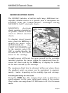
The objects that can be queried include depth contours, depth
areas, point objects (lights, navaids, landmarks, etc.), land ar-
eas, spot soundings, coastlines, rocks, wrecks and, in gen-
eral, any symbol present on the chart.
By querying the lights and navaids, the X-plain™ function
will give the description of the object in natural language,
thus avoiding the use of abbreviations and symbols difficult to
understand.
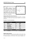
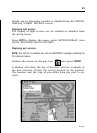
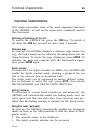
Chart presentation mode
The symbols used to represent the objects on the chart (buoys,
lights, landmarks, etc.), as well as chart colors, can be se-
lected between paper-chart International or US styles.