


26
English
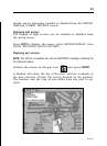
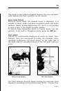
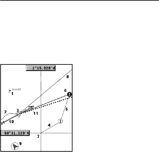
GRAPHIC ITEMS
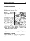
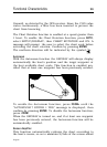
Besides chart data, the GEONAV displays some graphic items
useful during navigation.
The figure below shows some of these items.
1 - Marker
Indicates a point of interest as-
sociated with a symbol, a name
and a color.
2 - Track segment
Recording of the track actually
followed by the boat; the track is
displayed as a colored dashed
line.
3 - Boat’s position
Boat’s position according to the
data received from the GPS re-
ceiver.
4 - Rubber band
Line joining the last waypoint entered to the manual cursor,
or the boat’s position to the manual cursor when no waypoint
has been entered.
To delete this band, press the EXIT key and switch to Naviga-
tion mode.
5 - Route leg
Part of route between two waypoints.
6 - Waypoint
Waypoints are identified by a circle and a number. The route
starting point is marked by the “X” symbol. The target waypoint
is identified by a filled circle, whereas the route leg currently
followed is identified by a thicker line.
Graphic Items