


51
English
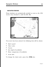
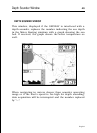
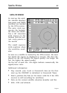
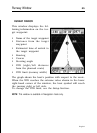
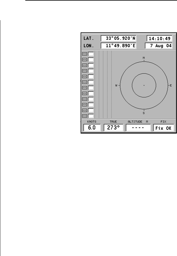
SATELLITE WINDOW
At start-up the satel-
lite window displays
how many and which
satellites are tracked
by the GPS receiver.
The outer circle rep-
resents the horizon,
the inner one identi-
fies a 45° elevation
with respect to the
horizon, and the cen-
tral circle points to
the zenith.
The small squares
with numbers show
the satellites avail-
able.
As soon as a satellite is tracked by the GPS receiver, the num-
ber inside the square is displayed in reverse. The bars dis-
played on the left identify the signal quality; the longer the
bar, the higher the signal quality.
On the left of each bar, two digits indicate numerically the
signal/noise ratio.
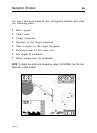
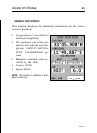
Additional information:
• Day, month, year, local or Greenwich time (at the first
start-up the GEONAV is initialized to Greenwich Time).
• Boat’s position (lat/lon) (or the latest valid fix if the GPS
receiver is still searching for satellites).
• Data on the current satellite situation (number and fix).
• SOG, COG and altitude.
Satellite Window