


66
English
MARKERS
Markers are used to identify points of interest to which names
and symbols can be assigned.
When a marker is entered, the plotter records also date, time
and sea depth and temperature (if available). This data is stored
together with the marker name, symbol and color and can be
displayed in the window shown by the GOTO MRK menu.
NOTE: Marker names are displayed starting from the 32 NM chart scale.
CURSOR MODE
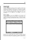
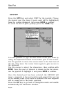
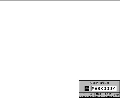
Inserting a marker
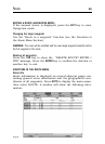
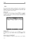
Move the cursor to the position desired
and hold the ENTER key pressed. A win-
dow will display the symbol and a name
automatically assigned to the marker.
Use the joystick and the -ZOOM+ key to change the marker
symbol (8 symbols available), name (max. 8 characters) and
color according to the type of marker to store (e.g., fishing
spots, wrecks, rocks, etc.). Press ENTER to confirm the inser-
tion.
NOTE: The cursor can be moved to the desired position also by using the GOTO
functions.
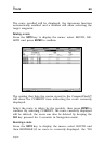
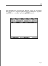
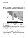
Changing a marker name/symbol/color
Position the cursor on the marker desired and press ENTER; a
window will display the symbol, the name and the color pre-
viously assigned to the marker selected. Use the joystick and
the -ZOOM+ key to change the marker name, symbol and color.
Press ENTER to confirm the operation.
Deleting a marker
Position the cursor on the marker to delete and press CLR.
Markers