


9. CUSTOMIZING YOUR UNIT
9-15
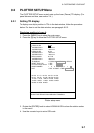
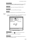
SET GOTO METHOD
Selects the method by which to navigate to a quick point from among 1 POINT,
35 POINTS, NEAR SERVICE and PORT SERVICE. (See paragraph 7.1.)
RANGE/SCALE
Selects the method how to show the display width, RANGE or SCALE.
SCALE DISPLAY
Turns the scale on or off in the PLOTTER (or PILOT) display.
GPS STATUS
Turns GPS status abbreviations on or off in the PLOTTER (or PILOT) display.
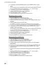
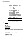
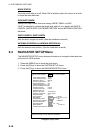
Page 2
▪ On page 1 of the DISPLAY SETUP menu, rotate the [ENTER] knob to select
NEXT PAGE to show page 2 of the DISPLAY SETUP menu.
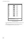
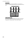
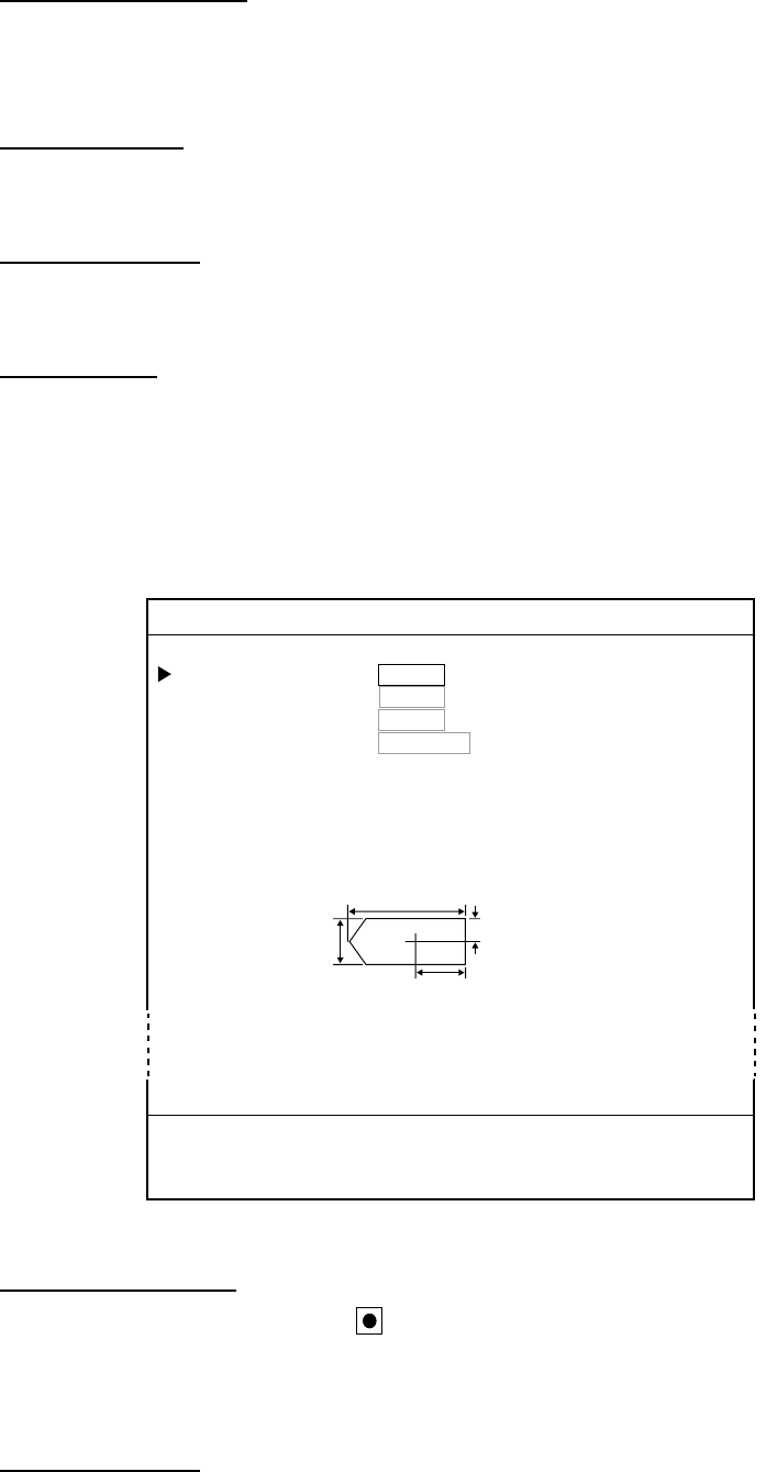
0-1. DISPLAY SETUP 2/2
PREVIOUS PAGE
WAYPOINT STATUS 1. ON 2. OFF
WAYPOINT INFO 1. ON 2. OFF
MARK STATUS 1. ON 2. OFF
OWN SHIP'S MARK 1. LARGE 2. SMALL 3. SHIP
SHIP'S LENGTH 10.0 m (0.1 99.9 m)
SHIP'S WIDTH 02.0 m (0.1 99.9 m)
ANTENNA POSITION Va 05.0 m (0.1 99.9 m)
ANTENNA POSITION Hb 01.0 m (0.1 99.9 m)
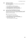
TURN KNOB TO SELECT MENU.
SELECT ITEM OF EACH MENU BY TRACKBALL.
L
b
a
W
Display setup menu (Page 2)
WAYPOINT STATUS
Turns the waypoint status icon (
) on or off on the PLOTTER (or PILOT)
display.
This icon shows the current shape and color of waypoints.
WAYPOINT INFO
Turns the waypoint data on or off. When ON is selected, place the cursor on a
waypoint to show the waypoint data box.