


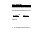
4-9
4 DISTANCE MEASUREMENT
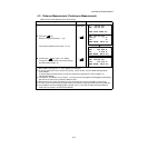
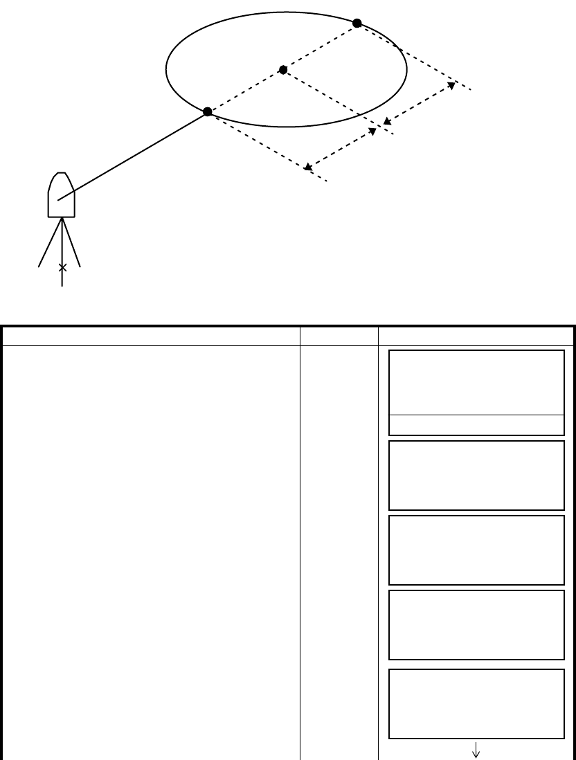
4.7.2 Distance Offset Measurement
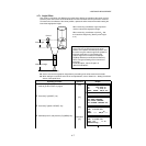
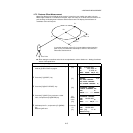
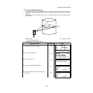
Measuring distance and coordinate of the center of a pond or a tree of which the radius is known.
Measuring the distance or coordinate till P0 point, input
oHD value as an offset value and measure P1
point showing as following draw in distance offset measurement. The display shows distance or
coordinate value until P0 point.
● When setting the coordinate value for the occupied station, refer to Section 5.1 “Setting Coordinate
Values of Occupied Point”.
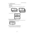
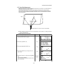
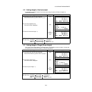
Operating procedure Operation Display
1 Press the [F4](P1
↓
) key from distance measuring
mode to get the function on page 2.
[F4]
2 Press the [F1](OFSET) key.
[F1]
3 Press the [F2](DIST. OFFSET) key.
[F2]
4 Press the [F1](INPUT) key and enter a offset
value, and press the [F4](ENTER) key.
[F1]
Offset
value
[F4]
5 Collimate prism P1, and press the [F1](MEAS)
key.
Measuring will start.
Collimate
P1
[F1]
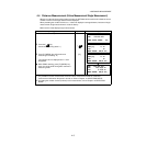
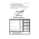
Occ. Point
oHD < 0
oHD >0
P1
P1
P0
In case the measuring point of (P1) is front side than that of requiring
point of (P0), the offset value shall be plus, and if it is rear side, the
offset value shall be minus.
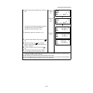
HR: 120°30'40"
HD: 123.456 m
VD: 5.678 m
MEAS MODE NP/P P1
↓
OFSET S.O S/A P2
↓
OFFSET 1/2
F1:ANG.OFFSET
F2:DIST.OFFSET
F3:PLANE OFFSET P
↓
DISTANCE OFFSET
INPUT FORWARD HD
oHD: m
INPUT --- --- ENTER
DISTANCE OFFSET
HR: 80°30'40"
HD: m
MEAS --- NP/P ---
DISTANCE OFFSET
HR: 80°30'40"
HD* [n] << m
>Measuring...