


7 DATA COLLECTION
7-17
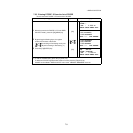
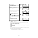
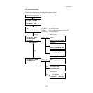
7.4 NEZ Auto Calculation
As measured data is collected, coordinates are calculated and stored for traverse or topo collection.
Automatic making out function of coordinate data sets up in CONFIG of data collect. Refer to Section
7.6 “Setting Parameter of Data Collect [CONFIG.]”.
As a default, coordinate data calculated will be saved in a file of the same name as the measurement
data file.
When the coordinate data file of the same name as the measurement data file does not exist, it will be
generated automatically.
It is possible to change a file for saving coordinate data in the DATA COLLECT Menu 2/2 (F1:SELECT
A FILE).
To calculate a coordinate data, it is necessary to add a point number in Data Collect execution.
When a coordinate data of the same point number exist already, it can be replaced with the new data by
confirming display.
● Coordinates will be calculated using the grid factor.
To set the grid factor, see Section 6.2“Setting the GRID FACTOR” .
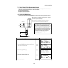
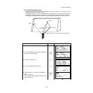
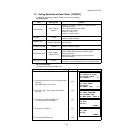
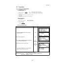
6 Collimate the left side of the column (P2) and
press the [F4](SET) key.
After the measurement, angle measuring display
of the right side (P3) will be shown.
Collimate
P2
[F4]
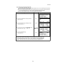
7 Collimate the right side of the column (P3) and
press the [F4](SET) key.
Collimate
P3
[F4]
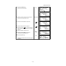
The distance between the instrument and center
of the column (P0) will be calculated.
To show the relative elevation (VD), press the
[] key.
Each time pressing the [ ] key, horizontal
distance, relative elevation and slope distance are
shown in sequence.
To show coordinate of point P0, press the [ ]
key.
[]
8 Press the [F3](YES) key. The display returns to the
next point number in data collect mode.
[F3]
COLUMN OFFSET
Left
N
P
HR: 120°30'40"
--- --- --- SET
COLUMN OFFSET
Right
N
P
HR: 180°30'40"
--- --- --- SET
COLUMN OFFSET
HR: 150°30'40"
N
P
HD: 43.321 m
>OK? [YES][NO]
COLUMN OFFSET
HR: 150°30'40"
N
P
VD: 2.321 m
>OK? [YES][NO]
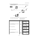
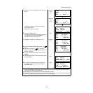
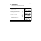
PT#
→
PT-12
PCODE :TOPCON
N
P
R.HT : 1.200 m
INPUT SRCH MEAS ALL