


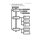

6 SPECIAL MODE (Menu Mode)
6-7
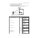
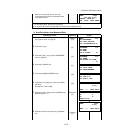
● How to use coordinate data
It is possible to input coordinate value directly or calculate from coordinate data file
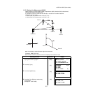
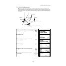
The horizontal distance (dHD) and relative
elevation (dVD) between prism A and C.
12 To measure the distance between points A and D,
repeat procedure 12 to14. *1)
*1) To return to previous mode, press the [ESC] key.
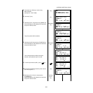
Operating procedure Operation Display
To use coordinate data file, select “USE FILE”
in step
4.
After procedure
6.
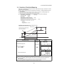
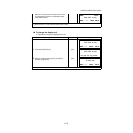
1 Press the [F3](NEZ) key.
Direct key input display will be shown.
[F3]
2 Press the [F3](PT#) key to use coordinate data
file.
Point number input display will be shown.
Pressing the [F3](HD) key, the display will return
to procedure
6.
After selecting coordinate input mode by pressing
the [F3](NEZ or PT# or HD) key, press the
[F1](INPUT) key and enter the data.
[F3]
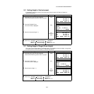
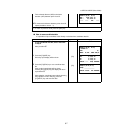
MLM-1(A-B, A-C)
dHD : 234.567 m
dVD : 23.456 m
––– ––– HD –––
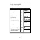
MLM-1(A-B, A-C)
<STEP-1>
HD: m
MEAS R.HT NEZ NP/P
N> 0.000 m
E: 0.000 m
Z: 0.000 m
INPUT ––– PT# ENTER
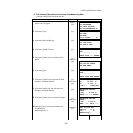
MLM-1(A-B,A-C)
PT#:__________
INPUT LIST HD ENTER