


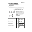

7 DATA COLLECTION
7-15
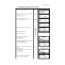
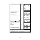
5 Measure the second and third points in the same
way. *1)
Collimate
P2
[F1]
Collimate
P3
[F1]
The display changes to PT# input in the plane
offset measurement.
Input point number if necessary.
6 Press the [F4](MEAS) key.
The instrument calculates and displays coordinate
and distance value of cross point between
collimation axis and of the plane. *2)
[F4]
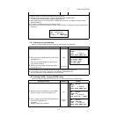
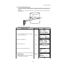
7 Collimate the edge (P0) of the plane. *3), 4)
Collimate
P0
8 To show the slope distance (SD), press the [ ]
key.
● Each time pressing the [ ] key, horizontal
distance, relative elevation and slope distance are
shown in sequence.
● To show coordinate value of point P0, press the
[] key.
9 Press the [F3](YES) key. Next offset point number
will be displayed.
[F3]
10 To escape the measuring, press the [ESC] key.
The display returns to the next point number in
data collect mode.
[ESC]
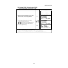
*1) In case the calculation of plane was not successful by the measured three points, error displays. Start
measuring over again from the first point.
*2) Data display is the mode beforehand of offset measurement mode.
*3) Error will be displayed when collimated to the direction which does not cross with the determined plane.
*4) The reflector height of the target point P0 is set to zero automatically
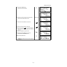
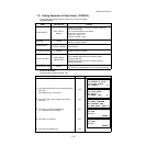
PLANE
N002#:
SD: m
MEAS --- NP/P ---
PLANE
N003#:
SD: m
MEAS --- NP/P ---
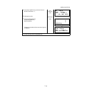
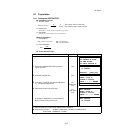
PLANE
PT#
→
PT-11
PCODE :TOPCON
INPUT SRCH --- MEAS
HR: 80°30'40"
HD: 54.321 m
VD: 10.000 m
>OK? [YES][NO]
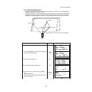
HR: 75°30'40"
HD: 54.600 m
VD: -0.487 m
>OK? [YES][NO]
V : 90°30'40"
HR: 75°30'40"
SD: 54.602 m
>OK? [YES][NO]
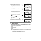
PLANE
PT#
→
PT-12
PCODE :TOPCON
INPUT SRCH --- MEAS
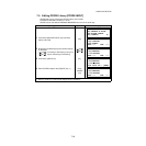
PT#
→
PT-12
PCODE :TOPCON
R.HT : 1.200 m
INPUT SRCH MEAS ALL