


11. CHART ALERTS
11-3
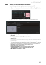
11.1.2 How to select objects used in chart alerts
You can also include calculation areas that have to be noted when sailing (for exam-
ple, restricted areas). To include these areas in chart alerts, do the following:
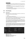
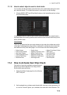
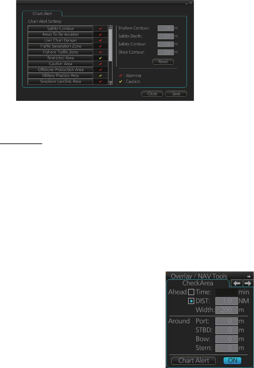
1. Click the [DISP], [SET] and [Chart Alert] buttons on the InstantAccess bar to show
the [Chart Alert] page.
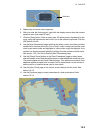
In the example above, a caution alert (visual) is provided when your vessel nears a
restricted area and a military practice area and both visual and aural alerts are provid-
ed for all other items.
List of areas
There are the areas that the chart radar detects and provides the audible alert and/or
visual alert if estimated own ship position or planned or monitored route crosses the
area defined on the [Chart Alert] page. You can choose from the following areas:
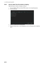
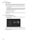
11.2 How to Activate Own Ship Check
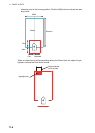
Calculation of own ship predicted movement area is
done using a check area about own ship position.
Set the check area as follows:
1. Select the [Check Area] page from the [Overlay/
NAV Tools] box.
2. Set the ahead time or distance and ahead width, referring to the figure below. Al-
so, set the "Around" figures: port, starboard, bow and stern check distance. The
• Safety Contour
• Areas To Be Avoided
• User Chart Danger
• Traffic Separation Zone
• Inshore Traffic Zone
• Restricted Area
• Caution Area
• Offshore Production Area
• Military Practice Area
• Seaplane Landing Area
• Submarine Transit Lane
• Anchorage Area
• Marine Farm/Aqua Culture
• PSSA Area
• Non-official ENC
• No Vector Chart
• Not Up-to-date
• Permit Expired